Justicia Social geodata
Justicia Social (Campeche) is a populated place; located in Mexico in America/Merida (GMT-6) time zone. With population of 818 people, there are 10682 cities with bigger population in this country. Compared to other cities in Mexico, 71.1% of cities are located further ↑North; 97.2% of cities are located further ←West and 82.4% of cities have higher elevation than Justicia Social. Note1


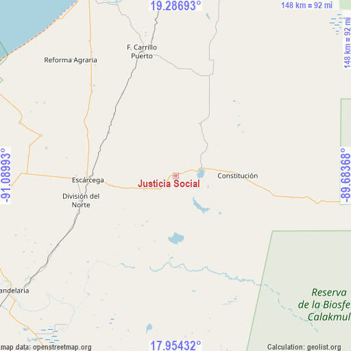
Justicia Social GPS coordinates[2]
18° 37' 18.948" North, 90° 23' 12.48" West
| Map corner | latitude | longitude |
|---|---|---|
| Upper-left | 19.28693°, | -91.08993° |
| Center: | 18.62193°, | -90.3868° |
| Lower-right: | 17.95432°, | -89.68368° |
| Map W x H: | 148.2×148.2 km | = 92.1×92.1mi |
| max Lat: | 32.7° ⇑71.1% North |
| Justicia Social: | 18.62193° |
| min Lat: | ⇓28.9% South 14.53588° |
| min Long | Justicia Social | max Long |
| -117.105° | -90.3868° | -86.73105° |
| W 97.2%⇐ | ⇒2.8% E |
Elevation
Elevation of Justicia Social is 66 m = 217 ft, and this is 1187.7 m = 3897 ft below average elevation for this country.
| Max E: |
3497 m = 11473 ft | 82.4% |
| Avg. | 1253.7 m = 4113 ft | |
| Justicia Social | 66 m = 217 ft | |
Min E: |
-1 m = -3 ft | 17.6% |
See also: Mexico elevation on elevation.city.
Geographical zone
Justicia Social is located in North Torrid zone (between Equator and Tropic of Cancer). Distance of this Northern Tropic circle is 535.4 km =332.7 mi to North.| Distance of | km | miles | from Justicia Social |
|---|---|---|---|
| North Pole | 7936.5 | 4931.5 | to North |
| Arctic Circle | 5330.6 | 3312.3 | to North |
| Tropic Cancer | 535.4 | 332.7 | to North |
| Equator | 2070.6 | 1286.6 | to South |


Nearby cities:
15 places around Justicia Social: (largest is in red/bold)
• Altamira de Zináparo
14.5 km =9 mi,  107°
107°
• Centenario
11.3 km =7 mi,  73°
73°
• Chan Laguna
24.4 km =15.2 mi,  129°
129°
• Cinco de Febrero
36.8 km =22.9 mi,  315°
315°
• Constitución
26.4 km =16.4 mi,  88°
88°
• División del Norte
41.1 km =25.5 mi,  255°
255°
• El Lechugal
4.5 km =2.8 mi,  240°
240°
• Escárcega
37.8 km =23.5 mi,  267°
267°
• La Libertad
14.6 km =9.1 mi,  246°
246°
• Laguna Grande
24.2 km =15 mi,  24°
24°
• Matamoros
27.7 km =17.2 mi, 261°
• Miguel Colorado
33.6 km =20.9 mi,  302°
302°
• Pablo García
26 km =16.2 mi, 90°
• Silvituc
12.4 km =7.7 mi,  79°
79°
• Xbonil
23.3 km =14.5 mi, 85°
Sources, notices
• [Note1] Compared only with cities in Mexico existing in our database
• [Src1] Map data: © OpenStreetMap contributors (CC-BY-SA)
• [Src2] Other city data from geonames.org with taken over terms of usage.
• [Src3] Geographical zone / Annual Mean Temperature by Robert A. Rohde @ Wikipedia
