Escárcega geodata
Escárcega (Campeche) is a populated place; located in Mexico in America/Merida (GMT-6) time zone. With population of 29,477 people, there are 338 cities with bigger population in this country. Compared to other cities in Mexico, 71.3% of cities are located further ↑North; 97% of cities are located further ←West and 80.9% of cities have higher elevation than Escárcega. Note1


Escárcega GPS coordinates[2]
18° 36' 32.076" North, 90° 44' 43.584" West
| Map corner | latitude | longitude |
|---|---|---|
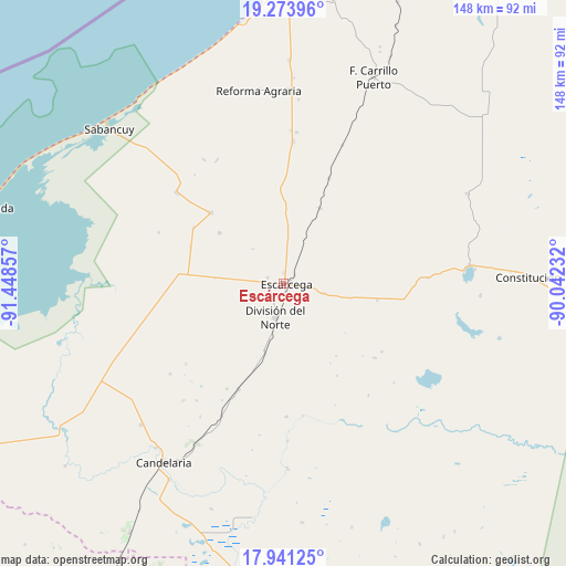
| Upper-left | 19.27396°, | -91.44857° |
| Center: | 18.60891°, | -90.74544° |
| Lower-right: | 17.94125°, | -90.04232° |
| Map W x H: | 148.2×148.2 km | = 92.1×92.1mi |
| max Lat: | 32.7° ⇑71.3% North |
| Escárcega: | 18.60891° |
| min Lat: | ⇓28.7% South 14.53588° |
| min Long | Escárcega | max Long |
| -117.105° | -90.74544° | -86.73105° |
| W 97%⇐ | ⇒3% E |
Elevation
Elevation of Escárcega is 83 m = 272 ft, and this is 1170.7 m = 3841 ft below average elevation for this country.
| Max E: |
3497 m = 11473 ft | 80.9% |
| Avg. | 1253.7 m = 4113 ft | |
| Escárcega | 83 m = 272 ft | |
Min E: |
-1 m = -3 ft | 19.1% |
See also: Mexico elevation on elevation.city.
Geographical zone
Escárcega is located in North Torrid zone (between Equator and Tropic of Cancer). Distance of this Northern Tropic circle is 536.8 km =333.6 mi to North.| Distance of | km | miles | from Escárcega |
|---|---|---|---|
| North Pole | 7937.9 | 4932.4 | to North |
| Arctic Circle | 5332.1 | 3313.2 | to North |
| Tropic Cancer | 536.8 | 333.6 | to North |
| Equator | 2069.1 | 1285.7 | to South |


Nearby cities:
15 places around Escárcega: (largest is in red/bold)
• Abelardo L. Rodríguez
21.4 km =13.3 mi,  308°
308°
• Chicbul
26.4 km =16.4 mi, 314°
• Cinco de Febrero
29.9 km =18.6 mi,  23°
23°
• División del Norte
9.1 km =5.7 mi,  192°
192°
• Don Samuel
30.1 km =18.7 mi,  203°
203°
• Haro
18.9 km =11.7 mi, 194°
• José de la Cruz Blanco
4.4 km =2.7 mi,  289°
289°
• La Libertad
24.8 km =15.4 mi,  99°
99°
• La Victoria
23 km =14.3 mi,  235°
235°
• Licenciado Gustavo Díaz Ordaz (18 de Marzo)
27.2 km =16.9 mi,  275°
275°
• Matamoros
10.8 km =6.7 mi, 104°
• Miguel Colorado
21.7 km =13.5 mi,  25°
25°
• Nuevo Progreso Dos
18 km =11.2 mi,  274°
274°
• Pital Nuevo
30.3 km =18.8 mi, 267°
• Plan de Ayala
26.9 km =16.7 mi, 313°
Sources, notices
• [Note1] Compared only with cities in Mexico existing in our database
• [Src1] Map data: © OpenStreetMap contributors (CC-BY-SA)
• [Src2] Other city data from geonames.org with taken over terms of usage.
• [Src3] Geographical zone / Annual Mean Temperature by Robert A. Rohde @ Wikipedia
