Potoichán geodata
Potoichán (Guerrero) is a populated place; located in Mexico in America/Mexico_City (GMT-6) time zone. With population of 559 people, there are 15266 cities with bigger population in this country. Compared to other cities in Mexico, 84% of cities are located further ↑North; 54.8% of cities are located further ←West and 52.8% of cities have lower elevation than Potoichán. Note1


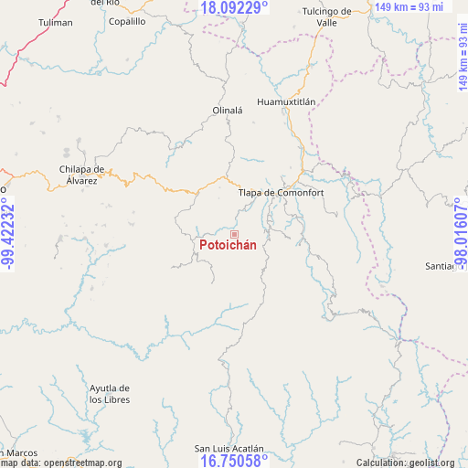
Potoichán GPS coordinates[2]
17° 25' 21.612" North, 98° 43' 9.084" West
| Map corner | latitude | longitude |
|---|---|---|
| Upper-left | 18.09229°, | -99.42232° |
| Center: | 17.42267°, | -98.71919° |
| Lower-right: | 16.75058°, | -98.01607° |
| Map W x H: | 149.2×149.2 km | = 92.7×92.7mi |
| max Lat: | 32.7° ⇑84% North |
| Potoichán: | 17.42267° |
| min Lat: | ⇓16% South 14.53588° |
| min Long | Potoichán | max Long |
| -117.105° | -98.71919° | -86.73105° |
| W 54.8%⇐ | ⇒45.2% E |
Elevation
Elevation of Potoichán is 1538 m = 5046 ft, and this is 284.3 m = 933 ft above average elevation for this country.
| Max E: |
3497 m = 11473 ft | 47.2% |
| Potoichán | 1538 m 5046 ft | |
| Avg. | 1253.7 m = 4113 ft | |
Min E: |
-1 m = -3 ft | 52.8% |
See also: Mexico elevation on elevation.city.
Geographical zone
Potoichán is located in North Torrid zone (between Equator and Tropic of Cancer). Distance of this Northern Tropic circle is 668.7 km =415.5 mi to North.| Distance of | km | miles | from Potoichán |
|---|---|---|---|
| North Pole | 8069.8 | 5014.3 | to North |
| Arctic Circle | 5464 | 3395.2 | to North |
| Tropic Cancer | 668.7 | 415.5 | to North |
| Equator | 1937.2 | 1203.7 | to South |


Nearby cities:
15 places around Potoichán: (largest is in red/bold)
• Ahuixotitla
9.6 km =6 mi,  249°
249°
• Colonia la Reforma
0.2 km =0.1 mi,  41°
41°
• Copanatoyac
4.6 km =2.9 mi,  7°
7°
• Huiztlatzala
6.3 km =3.9 mi,  238°
238°
• Moyotepec (Moyotepec de Juárez)
10.7 km =6.6 mi,  160°
160°
• Ocoapa
6.2 km =3.9 mi,  133°
133°
• Ocotequila
5.3 km =3.3 mi,  56°
56°
• Oztocingo
8.7 km =5.4 mi,  29°
29°
• Patlicha
1.9 km =1.2 mi,  351°
351°
• San Pedro Huitzapula Norte (Huitzapula Norte)
9.2 km =5.7 mi,  272°
272°
• San Vicente Amole
8.1 km =5 mi,  172°
172°
• Santa Anita
0.4 km =0.2 mi, 5°
• Tamaloya
12.1 km =7.5 mi, 247°
• Tlalquetzalapa
8.5 km =5.3 mi,  359°
359°
• Zapotitlán Tablas
6.5 km =4 mi, 271°
Sources, notices
• [Note1] Compared only with cities in Mexico existing in our database
• [Src1] Map data: © OpenStreetMap contributors (CC-BY-SA)
• [Src2] Other city data from geonames.org with taken over terms of usage.
• [Src3] Geographical zone / Annual Mean Temperature by Robert A. Rohde @ Wikipedia
