Camalotillo (El Camalotillo) geodata
Camalotillo (El Camalotillo) (Guerrero) is a populated place; located in Mexico in America/Mexico_City (GMT-6) time zone. With population of 558 people, there are 15286 cities with bigger population in this country. Compared to other cities in Mexico, 90.5% of cities are located further ↑North; 55.4% of cities are located further ←West and 67.9% of cities have higher elevation than Camalotillo (El Camalotillo). Note1
Current local time in Camalotillo (El Camalotillo):
08:30 AM, WednesdayDifference from your time zone: hours


Camalotillo (El Camalotillo) GPS coordinates[2]
16° 53' 4.128" North, 98° 40' 11.568" West
| Map corner | latitude | longitude |
|---|---|---|
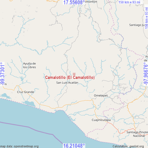
| Upper-left | 17.55608°, | -99.37301° |
| Center: | 16.88448°, | -98.66988° |
| Lower-right: | 16.21048°, | -97.96676° |
| Map W x H: | 149.6×149.6 km | = 93×93mi |
| max Lat: | 32.7° ⇑90.5% North |
| Camalotillo (El Camalotillo): | 16.88448° |
| min Lat: | ⇓9.5% South 14.53588° |
| min Long | Camalotillo (El | max Long |
| -117.105° | -98.66988° | -86.73105° |
| W 55.4%⇐ | ⇒44.6% E |
Elevation
Elevation of Camalotillo (El Camalotillo) is 533 m = 1749 ft, and this is 720.7 m = 2365 ft below average elevation for this country.
| Max E: |
3497 m = 11473 ft | 67.9% |
| Avg. | 1253.7 m = 4113 ft | |
| Camalotillo (El Camalotillo) | 533 m = 1749 ft | |
Min E: |
-1 m = -3 ft | 32.1% |
See also: Mexico elevation on elevation.city.
Geographical zone
Camalotillo (El Camalotillo) is located in North Torrid zone (between Equator and Tropic of Cancer). Distance of this Northern Tropic circle is 728.5 km =452.7 mi to North.| Distance of | km | miles | from Camalotillo (El Camalotillo) |
|---|---|---|---|
| North Pole | 8129.7 | 5051.6 | to North |
| Arctic Circle | 5523.8 | 3432.3 | to North |
| Tropic Cancer | 728.5 | 452.7 | to North |
| Equator | 1877.4 | 1166.6 | to South |


Nearby cities:
15 places around Camalotillo (El Camalotillo): (largest is in red/bold)
• Arroyo Cumiapa
5.9 km =3.7 mi,  100°
100°
• Buena Vista
12.8 km =8 mi,  47°
47°
• Cuanacaxtitlán
10 km =6.2 mi,  161°
161°
• El Aserradero
13.6 km =8.5 mi,  0°
0°
• El Carmen
12.3 km =7.6 mi,  229°
229°
• El Potrerillo (Potrerillo del Rincón)
10.4 km =6.5 mi,  321°
321°
• El Rincón (Santa Cruz del Rincón)
14.2 km =8.8 mi,  330°
330°
• Horcasitas
8.1 km =5 mi,  272°
272°
• Llano Silleta
8.5 km =5.3 mi, 45°
• Potrerillo Coapinole
9.8 km =6.1 mi,  337°
337°
• Pueblo Hidalgo
7.7 km =4.8 mi,  11°
11°
• San José Vista Hermosa
12 km =7.5 mi,  353°
353°
• San Luis Acatlán
10.8 km =6.7 mi,  218°
218°
• Tuxtepec (Cofradía)
9.6 km =6 mi, 352°
• Yoloxóchitl
7.8 km =4.8 mi,  192°
192°
Sources, notices
• [Note1] Compared only with cities in Mexico existing in our database
• [Src1] Map data: © OpenStreetMap contributors (CC-BY-SA)
• [Src2] Other city data from geonames.org with taken over terms of usage.
• [Src3] Geographical zone / Annual Mean Temperature by Robert A. Rohde @ Wikipedia
