Cuanacaxtitlán geodata
Cuanacaxtitlán (Guerrero) is a populated place; located in Mexico in America/Mexico_City (GMT-6) time zone. With population of 3,122 people, there are 2895 cities with bigger population in this country. Compared to other cities in Mexico, 91.8% of cities are located further ↑North; 55.7% of cities are located further ←West and 68.9% of cities have higher elevation than Cuanacaxtitlán. Note1


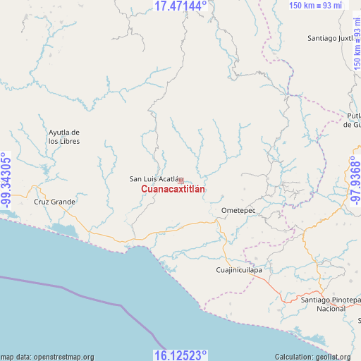
Cuanacaxtitlán GPS coordinates[2]
16° 47' 58.308" North, 98° 38' 23.712" West
| Map corner | latitude | longitude |
|---|---|---|
| Upper-left | 17.47144°, | -99.34305° |
| Center: | 16.79953°, | -98.63992° |
| Lower-right: | 16.12523°, | -97.9368° |
| Map W x H: | 149.7×149.7 km | = 93×93mi |
| max Lat: | 32.7° ⇑91.8% North |
| Cuanacaxtitlán: | 16.79953° |
| min Lat: | ⇓8.2% South 14.53588° |
| min Long | Cuanacaxtitlán | max Long |
| -117.105° | -98.63992° | -86.73105° |
| W 55.7%⇐ | ⇒44.3% E |
Elevation
Elevation of Cuanacaxtitlán is 473 m = 1552 ft, and this is 780.7 m = 2561 ft below average elevation for this country.
| Max E: |
3497 m = 11473 ft | 68.9% |
| Avg. | 1253.7 m = 4113 ft | |
| Cuanacaxtitlán | 473 m = 1552 ft | |
Min E: |
-1 m = -3 ft | 31.1% |
See also: Mexico elevation on elevation.city.
Geographical zone
Cuanacaxtitlán is located in North Torrid zone (between Equator and Tropic of Cancer). Distance of this Northern Tropic circle is 738 km =458.6 mi to North.| Distance of | km | miles | from Cuanacaxtitlán |
|---|---|---|---|
| North Pole | 8139.1 | 5057.4 | to North |
| Arctic Circle | 5533.2 | 3438.2 | to North |
| Tropic Cancer | 738 | 458.6 | to North |
| Equator | 1867.9 | 1160.7 | to South |


Nearby cities:
15 places around Cuanacaxtitlán: (largest is in red/bold)
• Acalmani
14.3 km =8.9 mi,  82°
82°
• Arcelia de Rodríguez
7 km =4.3 mi,  184°
184°
• Arroyo Cumiapa
8.8 km =5.5 mi,  17°
17°
• Azoyú
8.4 km =5.2 mi,  151°
151°
• Camalotillo (El Camalotillo)
10 km =6.2 mi,  341°
341°
• El Carmen
12.7 km =7.9 mi,  276°
276°
• Horcasitas
15 km =9.3 mi,  311°
311°
• Jolotichán
11 km =6.8 mi,  241°
241°
• Llano Silleta
15.7 km =9.8 mi,  10°
10°
• Maxmadi
6.5 km =4 mi,  122°
122°
• Quetzalapa
14.7 km =9.1 mi,  96°
96°
• San Luis Acatlán
10 km =6.2 mi, 276°
• Yoloxóchitl
5.3 km =3.3 mi,  290°
290°
• Zapotitlán de la Fuente (El Zapote)
8.1 km =5 mi,  166°
166°
• Zoyatlán
14.1 km =8.8 mi,  224°
224°
Sources, notices
• [Note1] Compared only with cities in Mexico existing in our database
• [Src1] Map data: © OpenStreetMap contributors (CC-BY-SA)
• [Src2] Other city data from geonames.org with taken over terms of usage.
• [Src3] Geographical zone / Annual Mean Temperature by Robert A. Rohde @ Wikipedia
