Yoloxóchitl geodata
Yoloxóchitl (Guerrero) is a populated place; located in Mexico in America/Mexico_City (GMT-6) time zone. With population of 3,191 people, there are 2830 cities with bigger population in this country. Compared to other cities in Mexico, 91.5% of cities are located further ↑North; 55.2% of cities are located further ←West and 66.4% of cities have higher elevation than Yoloxóchitl. Note1


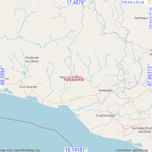
Yoloxóchitl GPS coordinates[2]
16° 48' 57.78" North, 98° 41' 10.572" West
| Map corner | latitude | longitude |
|---|---|---|
| Upper-left | 17.4879°, | -99.3894° |
| Center: | 16.81605°, | -98.68627° |
| Lower-right: | 16.14181°, | -97.98315° |
| Map W x H: | 149.7×149.7 km | = 93×93mi |
| max Lat: | 32.7° ⇑91.5% North |
| Yoloxóchitl: | 16.81605° |
| min Lat: | ⇓8.5% South 14.53588° |
| min Long | Yoloxóchitl | max Long |
| -117.105° | -98.68627° | -86.73105° |
| W 55.2%⇐ | ⇒44.8% E |
Elevation
Elevation of Yoloxóchitl is 618 m = 2028 ft, and this is 635.7 m = 2086 ft below average elevation for this country.
| Max E: |
3497 m = 11473 ft | 66.4% |
| Avg. | 1253.7 m = 4113 ft | |
| Yoloxóchitl | 618 m = 2028 ft | |
Min E: |
-1 m = -3 ft | 33.6% |
See also: Mexico elevation on elevation.city.
Geographical zone
Yoloxóchitl is located in North Torrid zone (between Equator and Tropic of Cancer). Distance of this Northern Tropic circle is 736.1 km =457.4 mi to North.| Distance of | km | miles | from Yoloxóchitl |
|---|---|---|---|
| North Pole | 8137.3 | 5056.3 | to North |
| Arctic Circle | 5531.4 | 3437.1 | to North |
| Tropic Cancer | 736.1 | 457.4 | to North |
| Equator | 1869.8 | 1161.8 | to South |


Nearby cities:
15 places around Yoloxóchitl: (largest is in red/bold)
• Arcelia de Rodríguez
9.9 km =6.2 mi,  153°
153°
• Arroyo Cumiapa
10 km =6.2 mi,  48°
48°
• Azoyú
12.9 km =8 mi,  135°
135°
• Camalotillo (El Camalotillo)
7.8 km =4.8 mi,  12°
12°
• Cuanacaxtitlán
5.3 km =3.3 mi,  110°
110°
• El Carmen
7.7 km =4.8 mi,  267°
267°
• Horcasitas
10.2 km =6.3 mi,  321°
321°
• Jolotichán
8.5 km =5.3 mi,  213°
213°
• Llano Silleta
15.7 km =9.8 mi,  30°
30°
• Maxmadi
11.7 km =7.3 mi,  116°
116°
• Miahuichán
13.1 km =8.1 mi,  263°
263°
• Pueblo Hidalgo
15.5 km =9.6 mi, 12°
• San Luis Acatlán
5.1 km =3.2 mi, 261°
• Zapotitlán de la Fuente (El Zapote)
11.9 km =7.4 mi, 145°
• Zoyatlán
12.9 km =8 mi,  202°
202°
Sources, notices
• [Note1] Compared only with cities in Mexico existing in our database
• [Src1] Map data: © OpenStreetMap contributors (CC-BY-SA)
• [Src2] Other city data from geonames.org with taken over terms of usage.
• [Src3] Geographical zone / Annual Mean Temperature by Robert A. Rohde @ Wikipedia
