Ek-Balam geodata
Ek-Balam (Yucatán) is a populated place; located in Mexico in America/Merida (GMT-6) time zone. With population of 569 people, there are 15027 cities with bigger population in this country. Compared to other cities in Mexico, 59.7% of cities are located further ↓South; 98.7% of cities are located further ←West and 86.7% of cities have higher elevation than Ek-Balam. Note1


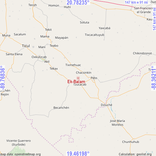
Ek-Balam GPS coordinates[2]
20° 7' 24.816" North, 89° 3' 54.828" West
| Map corner | latitude | longitude |
|---|---|---|
| Upper-left | 20.78235°, | -89.76836° |
| Center: | 20.12356°, | -89.06523° |
| Lower-right: | 19.46198°, | -88.36211° |
| Map W x H: | 146.8×146.8 km | = 91.2×91.2mi |
| max Lat: | 32.7° ⇑40.3% North |
| Ek-Balam: | 20.12356° |
| min Lat: | ⇓59.7% South 14.53588° |
| min Long | Ek-Balam | max Long |
| -117.105° | -89.06523° | -86.73105° |
| W 98.7%⇐ | ⇒1.3% E |
Elevation
Elevation of Ek-Balam is 35 m = 115 ft, and this is 1218.7 m = 3998 ft below average elevation for this country.
| Max E: |
3497 m = 11473 ft | 86.7% |
| Avg. | 1253.7 m = 4113 ft | |
| Ek-Balam | 35 m = 115 ft | |
Min E: |
-1 m = -3 ft | 13.3% |
See also: Mexico elevation on elevation.city.
Geographical zone
Ek-Balam is located in North Torrid zone (between Equator and Tropic of Cancer). Distance of this Northern Tropic circle is 368.4 km =228.9 mi to North.| Distance of | km | miles | from Ek-Balam |
|---|---|---|---|
| North Pole | 7769.5 | 4827.7 | to North |
| Arctic Circle | 5163.6 | 3208.5 | to North |
| Tropic Cancer | 368.4 | 228.9 | to North |
| Equator | 2237.5 | 1390.3 | to South |


Nearby cities:
15 places around Ek-Balam: (largest is in red/bold)
• Catmis
22.1 km =13.7 mi,  146°
146°
• Chacsinkin
7.4 km =4.6 mi,  43°
43°
• Kimbila
19.3 km =12 mi,  353°
353°
• Kinil
23.4 km =14.5 mi,  342°
342°
• Peto
14.9 km =9.3 mi,  88°
88°
• Sabacché
21.7 km =13.5 mi,  10°
10°
• Tahdziu
15.4 km =9.6 mi,  54°
54°
• Tecax
24.7 km =15.3 mi,  291°
291°
• Ticum
16.1 km =10 mi,  279°
279°
• Timul
24.7 km =15.3 mi,  32°
32°
• Tixcuytun
17.4 km =10.8 mi,  303°
303°
• Tixmehuac
13.3 km =8.3 mi, 340°
• Tzucacab
5.9 km =3.7 mi,  164°
164°
• Xaya
23 km =14.3 mi,  326°
326°
• Xoy
9.9 km =6.2 mi, 89°
Sources, notices
• [Note1] Compared only with cities in Mexico existing in our database
• [Src1] Map data: © OpenStreetMap contributors (CC-BY-SA)
• [Src2] Other city data from geonames.org with taken over terms of usage.
• [Src3] Geographical zone / Annual Mean Temperature by Robert A. Rohde @ Wikipedia
