Vargas geodata
Vargas (Veracruz) is a populated place; located in Mexico in America/Mexico_City (GMT-6) time zone. With population of 2,519 people, there are 3516 cities with bigger population in this country. Compared to other cities in Mexico, 60.5% of cities are located further ↑North; 80.8% of cities are located further ←West and 90.4% of cities have higher elevation than Vargas. Note1


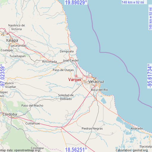
Vargas GPS coordinates[2]
19° 13' 39.864" North, 96° 19' 13.656" West
| Map corner | latitude | longitude |
|---|---|---|
| Upper-left | 19.89029°, | -97.02359° |
| Center: | 19.22774°, | -96.32046° |
| Lower-right: | 18.56251°, | -95.61734° |
| Map W x H: | 147.6×147.6 km | = 91.7×91.7mi |
| max Lat: | 32.7° ⇑60.5% North |
| Vargas: | 19.22774° |
| min Lat: | ⇓39.5% South 14.53588° |
| min Long | Vargas | max Long |
| -117.105° | -96.32046° | -86.73105° |
| W 80.8%⇐ | ⇒19.2% E |
Elevation
Elevation of Vargas is 23 m = 75 ft, and this is 1230.7 m = 4038 ft below average elevation for this country.
| Max E: |
3497 m = 11473 ft | 90.4% |
| Avg. | 1253.7 m = 4113 ft | |
| Vargas | 23 m = 75 ft | |
Min E: |
-1 m = -3 ft | 9.6% |
See also: Mexico elevation on elevation.city.
Geographical zone
Vargas is located in North Torrid zone (between Equator and Tropic of Cancer). Distance of this Northern Tropic circle is 468 km =290.8 mi to North.| Distance of | km | miles | from Vargas |
|---|---|---|---|
| North Pole | 7869.1 | 4889.6 | to North |
| Arctic Circle | 5263.2 | 3270.4 | to North |
| Tropic Cancer | 468 | 290.8 | to North |
| Equator | 2137.9 | 1328.4 | to South |


Nearby cities:
15 places around Vargas: (largest is in red/bold)
• Belisario Domínguez
6.5 km =4 mi,  194°
194°
• Cabo Verde
6.5 km =4 mi,  161°
161°
• Cerro Guzmán
6.2 km =3.9 mi,  277°
277°
• Delfino Victoria (Santa Fe)
5.4 km =3.4 mi,  114°
114°
• El Buzón
8.4 km =5.2 mi,  201°
201°
• El Pando
4.8 km =3 mi,  138°
138°
• El Pochote
8.6 km =5.3 mi,  264°
264°
• Loma del Nanche
7.4 km =4.6 mi,  246°
246°
• Paso Real
6.7 km =4.2 mi,  221°
221°
• Paso San Juan
2.9 km =1.8 mi, 187°
• Plan del Manantial
5.6 km =3.5 mi, 260°
• Puente Jula
4.2 km =2.6 mi, 223°
• Pureza
6.3 km =3.9 mi,  4°
4°
• San Julián
6.5 km =4 mi,  59°
59°
• Tierra Colorada
5.1 km =3.2 mi,  267°
267°
Sources, notices
• [Note1] Compared only with cities in Mexico existing in our database
• [Src1] Map data: © OpenStreetMap contributors (CC-BY-SA)
• [Src2] Other city data from geonames.org with taken over terms of usage.
• [Src3] Geographical zone / Annual Mean Temperature by Robert A. Rohde @ Wikipedia
