Guillermo Prieto geodata
Guillermo Prieto (Veracruz) is a populated place; located in Mexico in America/Mexico_City (GMT-6) time zone. With population of 1,163 people, there are 7459 cities with bigger population in this country. Compared to other cities in Mexico, 76.7% of cities are located further ↑North; 85.7% of cities are located further ←West and 89.4% of cities have higher elevation than Guillermo Prieto. Note1


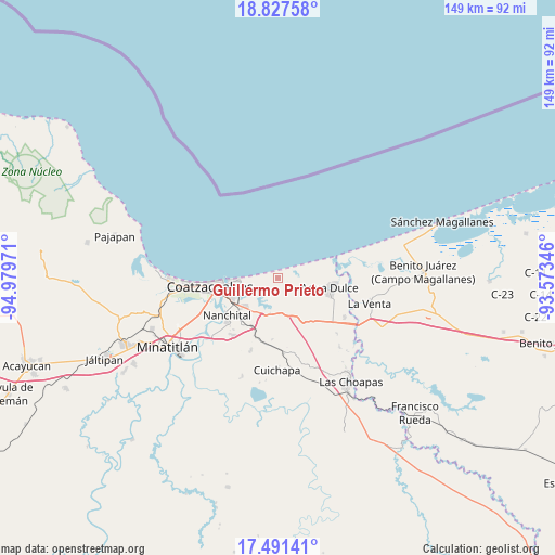
Guillermo Prieto GPS coordinates[2]
18° 9' 38.772" North, 94° 16' 35.688" West
| Map corner | latitude | longitude |
|---|---|---|
| Upper-left | 18.82758°, | -94.97971° |
| Center: | 18.16077°, | -94.27658° |
| Lower-right: | 17.49141°, | -93.57346° |
| Map W x H: | 148.6×148.6 km | = 92.3×92.3mi |
| max Lat: | 32.7° ⇑76.7% North |
| Guillermo Prieto: | 18.16077° |
| min Lat: | ⇓23.3% South 14.53588° |
| min Long | Guillermo Priet | max Long |
| -117.105° | -94.27658° | -86.73105° |
| W 85.7%⇐ | ⇒14.3% E |
Elevation
Elevation of Guillermo Prieto is 26 m = 85 ft, and this is 1227.7 m = 4028 ft below average elevation for this country.
| Max E: |
3497 m = 11473 ft | 89.4% |
| Avg. | 1253.7 m = 4113 ft | |
| Guillermo Prieto | 26 m = 85 ft | |
Min E: |
-1 m = -3 ft | 10.6% |
See also: Mexico elevation on elevation.city.
Geographical zone
Guillermo Prieto is located in North Torrid zone (between Equator and Tropic of Cancer). Distance of this Northern Tropic circle is 586.6 km =364.5 mi to North.| Distance of | km | miles | from Guillermo Prieto |
|---|---|---|---|
| North Pole | 7987.8 | 4963.4 | to North |
| Arctic Circle | 5381.9 | 3344.2 | to North |
| Tropic Cancer | 586.6 | 364.5 | to North |
| Equator | 2019.3 | 1254.7 | to South |


Nearby cities:
15 places around Guillermo Prieto: (largest is in red/bold)
• Agua Dulce
14.1 km =8.8 mi,  99°
99°
• Allende
12.3 km =7.6 mi,  267°
267°
• Calzadas
20 km =12.4 mi,  250°
250°
• Coatzacoalcos
17.8 km =11.1 mi, 265°
• Colorado
4.8 km =3 mi, 265°
• Cuauhtemoczin
16.6 km =10.3 mi,  73°
73°
• El Chapo
15 km =9.3 mi,  211°
211°
• El Veinticinco
16.7 km =10.4 mi,  202°
202°
• Ixhuatlán del Sureste
19.5 km =12.1 mi,  217°
217°
• La Candelaria [Unidad Habitacional]
18.4 km =11.4 mi, 224°
• Las Águilas
18.3 km =11.4 mi, 220°
• Mundo Nuevo
14.5 km =9 mi,  236°
236°
• Nanchital de Lázaro Cárdenas del Río
17.1 km =10.6 mi,  234°
234°
• Nuevo Teapa
10.8 km =6.7 mi, 205°
• Tonalá
15.1 km =9.4 mi, 70°
Sources, notices
• [Note1] Compared only with cities in Mexico existing in our database
• [Src1] Map data: © OpenStreetMap contributors (CC-BY-SA)
• [Src2] Other city data from geonames.org with taken over terms of usage.
• [Src3] Geographical zone / Annual Mean Temperature by Robert A. Rohde @ Wikipedia
