Las Águilas geodata
Las Águilas (Veracruz) is a populated place; located in Mexico in America/Mexico_City (GMT-6) time zone. With population of 543 people, there are 15651 cities with bigger population in this country. Compared to other cities in Mexico, 78.2% of cities are located further ↑North; 85.6% of cities are located further ←West and 85.3% of cities have higher elevation than Las Águilas. Note1


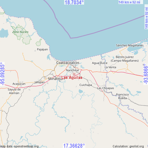
Las Águilas GPS coordinates[2]
18° 2' 9.996" North, 94° 23' 22.992" West
| Map corner | latitude | longitude |
|---|---|---|
| Upper-left | 18.7034°, | -95.09285° |
| Center: | 18.03611°, | -94.38972° |
| Lower-right: | 17.36628°, | -93.6866° |
| Map W x H: | 148.7×148.7 km | = 92.4×92.4mi |
| max Lat: | 32.7° ⇑78.2% North |
| Las Águilas: | 18.03611° |
| min Lat: | ⇓21.8% South 14.53588° |
| min Long | Las Águilas | max Long |
| -117.105° | -94.38972° | -86.73105° |
| W 85.6%⇐ | ⇒14.4% E |
Elevation
Elevation of Las Águilas is 42 m = 138 ft, and this is 1211.7 m = 3975 ft below average elevation for this country.
| Max E: |
3497 m = 11473 ft | 85.3% |
| Avg. | 1253.7 m = 4113 ft | |
| Las Águilas | 42 m = 138 ft | |
Min E: |
-1 m = -3 ft | 14.7% |
See also: Mexico elevation on elevation.city.
Geographical zone
Las Águilas is located in North Torrid zone (between Equator and Tropic of Cancer). Distance of this Northern Tropic circle is 600.5 km =373.1 mi to North.| Distance of | km | miles | from Las Águilas |
|---|---|---|---|
| North Pole | 8001.6 | 4972 | to North |
| Arctic Circle | 5395.7 | 3352.7 | to North |
| Tropic Cancer | 600.5 | 373.1 | to North |
| Equator | 2005.4 | 1246.1 | to South |


Nearby cities:
15 places around Las Águilas: (largest is in red/bold)
• Allende
13.2 km =8.2 mi,  358°
358°
• Calzadas
10 km =6.2 mi,  316°
316°
• Coatzacoalcos
13.8 km =8.6 mi,  335°
335°
• Colorado
15.3 km =9.5 mi,  27°
27°
• Cuichapa
15.9 km =9.9 mi,  132°
132°
• El Chapo
4.2 km =2.6 mi,  74°
74°
• El Veinticinco
5.7 km =3.5 mi,  105°
105°
• Ixhuatlán del Sureste
1.6 km =1 mi,  175°
175°
• La Candelaria [Unidad Habitacional]
1.3 km =0.8 mi,  310°
310°
• La Guadalupana
17.6 km =10.9 mi, 308°
• Moloacán
7.2 km =4.5 mi,  141°
141°
• Mundo Nuevo
5.8 km =3.6 mi, 359°
• Nanchital de Lázaro Cárdenas del Río
4.3 km =2.7 mi,  334°
334°
• Nuevo Teapa
8.4 km =5.2 mi,  60°
60°
• Tlacuilolapan
14.9 km =9.3 mi,  115°
115°
Sources, notices
• [Note1] Compared only with cities in Mexico existing in our database
• [Src1] Map data: © OpenStreetMap contributors (CC-BY-SA)
• [Src2] Other city data from geonames.org with taken over terms of usage.
• [Src3] Geographical zone / Annual Mean Temperature by Robert A. Rohde @ Wikipedia
