Allende geodata
Allende (Veracruz) is a populated place; located in Mexico in America/Mexico_City (GMT-6) time zone. With population of 23,620 people, there are 432 cities with bigger population in this country. Compared to other cities in Mexico, 76.8% of cities are located further ↑North; 85.6% of cities are located further ←West and 93% of cities have higher elevation than Allende. Note1


Allende GPS coordinates[2]
18° 9' 18.504" North, 94° 23' 34.404" West
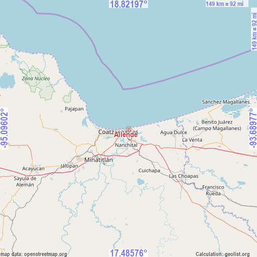
| Map corner | latitude | longitude |
|---|---|---|
| Upper-left | 18.82197°, | -95.09602° |
| Center: | 18.15514°, | -94.39289° |
| Lower-right: | 17.48576°, | -93.68977° |
| Map W x H: | 148.6×148.6 km | = 92.3×92.3mi |
| max Lat: | 32.7° ⇑76.8% North |
| Allende: | 18.15514° |
| min Lat: | ⇓23.2% South 14.53588° |
| min Long | Allende | max Long |
| -117.105° | -94.39289° | -86.73105° |
| W 85.6%⇐ | ⇒14.4% E |
Elevation
Elevation of Allende is 17 m = 56 ft, and this is 1236.7 m = 4057 ft below average elevation for this country.
| Max E: |
3497 m = 11473 ft | 93% |
| Avg. | 1253.7 m = 4113 ft | |
| Allende | 17 m = 56 ft | |
Min E: |
-1 m = -3 ft | 7% |
See also: Mexico elevation on elevation.city.
Geographical zone
Allende is located in North Torrid zone (between Equator and Tropic of Cancer). Distance of this Northern Tropic circle is 587.3 km =364.9 mi to North.| Distance of | km | miles | from Allende |
|---|---|---|---|
| North Pole | 7988.4 | 4963.8 | to North |
| Arctic Circle | 5382.5 | 3344.5 | to North |
| Tropic Cancer | 587.3 | 364.9 | to North |
| Equator | 2018.7 | 1254.4 | to South |


Nearby cities:
15 places around Allende: (largest is in red/bold)
• Calzadas
8.9 km =5.5 mi,  227°
227°
• Centro de Readaptación Social
13.4 km =8.3 mi,  261°
261°
• Coatzacoalcos
5.5 km =3.4 mi, 262°
• Colorado
7.5 km =4.7 mi,  87°
87°
• El Chapo
12.9 km =8 mi,  160°
160°
• Guillermo Prieto
12.3 km =7.6 mi, 87°
• Ixhuatlán del Sureste
14.9 km =9.3 mi,  178°
178°
• La Candelaria [Unidad Habitacional]
12.4 km =7.7 mi, 183°
• La Guadalupana
13.7 km =8.5 mi, 260°
• Las Águilas
13.2 km =8.2 mi, 178°
• Lomas de Barrillas
14.1 km =8.8 mi,  266°
266°
• Mundo Nuevo
7.4 km =4.6 mi, 177°
• Nanchital de Lázaro Cárdenas del Río
9.5 km =5.9 mi,  189°
189°
• Nuevo Teapa
11.9 km =7.4 mi,  140°
140°
• Puerto Esmeralda
13.2 km =8.2 mi, 266°
Sources, notices
• [Note1] Compared only with cities in Mexico existing in our database
• [Src1] Map data: © OpenStreetMap contributors (CC-BY-SA)
• [Src2] Other city data from geonames.org with taken over terms of usage.
• [Src3] Geographical zone / Annual Mean Temperature by Robert A. Rohde @ Wikipedia
