Alto Lucero geodata
Alto Lucero (Veracruz) is a populated place; located in Mexico in America/Mexico_City (GMT-6) time zone. With population of 15,011 people, there are 642 cities with bigger population in this country. Compared to other cities in Mexico, 75.8% of cities are located further ↓South; 70.1% of cities are located further ←West and 86.3% of cities have higher elevation than Alto Lucero. Note1


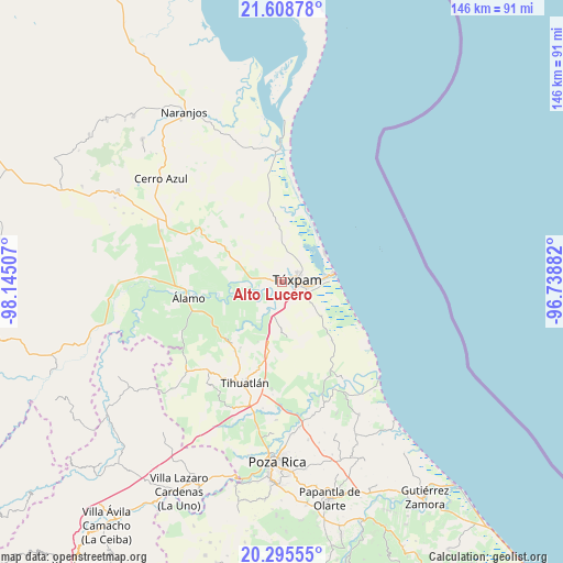
Alto Lucero GPS coordinates[2]
20° 57' 12.996" North, 97° 26' 30.984" West
| Map corner | latitude | longitude |
|---|---|---|
| Upper-left | 21.60878°, | -98.14507° |
| Center: | 20.95361°, | -97.44194° |
| Lower-right: | 20.29555°, | -96.73882° |
| Map W x H: | 146×146 km | = 90.7×90.7mi |
| max Lat: | 32.7° ⇑24.2% North |
| Alto Lucero: | 20.95361° |
| min Lat: | ⇓75.8% South 14.53588° |
| min Long | Alto Lucero | max Long |
| -117.105° | -97.44194° | -86.73105° |
| W 70.1%⇐ | ⇒29.9% E |
Elevation
Elevation of Alto Lucero is 37 m = 121 ft, and this is 1216.7 m = 3992 ft below average elevation for this country.
| Max E: |
3497 m = 11473 ft | 86.3% |
| Avg. | 1253.7 m = 4113 ft | |
| Alto Lucero | 37 m = 121 ft | |
Min E: |
-1 m = -3 ft | 13.7% |
See also: Mexico elevation on elevation.city.
Geographical zone
Alto Lucero is located in North Torrid zone (between Equator and Tropic of Cancer). Distance of this Northern Tropic circle is 276.1 km =171.6 mi to North.| Distance of | km | miles | from Alto Lucero |
|---|---|---|---|
| North Pole | 7677.2 | 4770.4 | to North |
| Arctic Circle | 5071.4 | 3151.2 | to North |
| Tropic Cancer | 276.1 | 171.6 | to North |
| Equator | 2329.8 | 1447.7 | to South |


Nearby cities:
15 places around Alto Lucero: (largest is in red/bold)
• Banderas
6.5 km =4 mi,  50°
50°
• Buenos Aires
6 km =3.7 mi,  274°
274°
• Ceiba Rica
7.1 km =4.4 mi,  176°
176°
• Chacoaco
9.3 km =5.8 mi,  126°
126°
• Cobos
8.4 km =5.2 mi,  100°
100°
• Colonia México Lindo
2 km =1.2 mi,  260°
260°
• Cruz Naranjos
2.3 km =1.4 mi,  3°
3°
• Doctor Montes de Oca
12 km =7.5 mi, 259°
• Higueral
5.9 km =3.7 mi, 271°
• La Victoria (La Peñita)
7.4 km =4.6 mi, 104°
• Ojite Rancho Nuevo
9.1 km =5.7 mi,  281°
281°
• San Miguel
10.9 km =6.8 mi, 267°
• Santiago de la Peña
4 km =2.5 mi, 103°
• Tierra Blanca
8.9 km =5.5 mi,  192°
192°
• Túxpam de Rodríguez Cano
3.5 km =2.2 mi,  82°
82°
Sources, notices
• [Note1] Compared only with cities in Mexico existing in our database
• [Src1] Map data: © OpenStreetMap contributors (CC-BY-SA)
• [Src2] Other city data from geonames.org with taken over terms of usage.
• [Src3] Geographical zone / Annual Mean Temperature by Robert A. Rohde @ Wikipedia
