La Trinidad geodata
La Trinidad (Querétaro) is a populated place; located in Mexico in America/Mexico_City (GMT-6) time zone. With population of 1,836 people, there are 4733 cities with bigger population in this country. Compared to other cities in Mexico, 68.1% of cities are located further ↓South; 63.5% of cities are located further →East and 71.9% of cities have lower elevation than La Trinidad. Note1


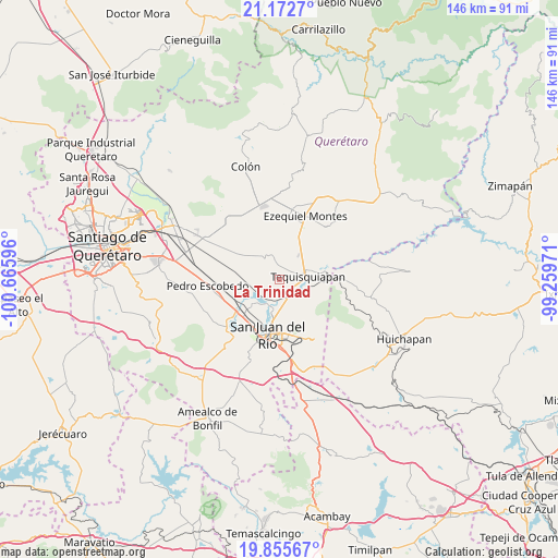
La Trinidad GPS coordinates[2]
20° 30' 56.16" North, 99° 57' 46.188" West
| Map corner | latitude | longitude |
|---|---|---|
| Upper-left | 21.1727°, | -100.66596° |
| Center: | 20.5156°, | -99.96283° |
| Lower-right: | 19.85567°, | -99.25971° |
| Map W x H: | 146.4×146.4 km | = 91×91mi |
| max Lat: | 32.7° ⇑31.9% North |
| La Trinidad: | 20.5156° |
| min Lat: | ⇓68.1% South 14.53588° |
| min Long | La Trinidad | max Long |
| -117.105° | -99.96283° | -86.73105° |
| W 36.5%⇐ | ⇒63.5% E |
Elevation
Elevation of La Trinidad is 1965 m = 6447 ft, and this is 711.3 m = 2334 ft above average elevation for this country.
| Max E: |
3497 m = 11473 ft | 28.1% |
| La Trinidad | 1965 m 6447 ft | |
| Avg. | 1253.7 m = 4113 ft | |
Min E: |
-1 m = -3 ft | 71.9% |
See also: Mexico elevation on elevation.city.
Geographical zone
La Trinidad is located in North Torrid zone (between Equator and Tropic of Cancer). Distance of this Northern Tropic circle is 324.8 km =201.8 mi to North.| Distance of | km | miles | from La Trinidad |
|---|---|---|---|
| North Pole | 7725.9 | 4800.7 | to North |
| Arctic Circle | 5120.1 | 3181.5 | to North |
| Tropic Cancer | 324.8 | 201.8 | to North |
| Equator | 2281.1 | 1417.4 | to South |


Nearby cities:
15 places around La Trinidad: (largest is in red/bold)
• Bordo Blanco
4.2 km =2.6 mi,  120°
120°
• El Cerrito
8.1 km =5 mi, 121°
• El Mirador
8.4 km =5.2 mi,  171°
171°
• Fuentezuelas
4.9 km =3 mi,  335°
335°
• La Fuente
8.6 km =5.3 mi,  298°
298°
• La Laja
6.8 km =4.2 mi, 344°
• La Llave
6.4 km =4 mi,  210°
210°
• La Tortuga
7.1 km =4.4 mi,  35°
35°
• La Valla
6.9 km =4.3 mi,  255°
255°
• Nahui Ollin [Fraccionamiento]
7.8 km =4.8 mi,  98°
98°
• Pueblo Quieto
7.9 km =4.9 mi,  184°
184°
• San Nicolás
5 km =3.1 mi,  148°
148°
• Santillán
9.8 km =6.1 mi,  14°
14°
• Tequisquiapan
7.4 km =4.6 mi,  84°
84°
• Visthá
7.8 km =4.8 mi,  190°
190°
Sources, notices
• [Note1] Compared only with cities in Mexico existing in our database
• [Src1] Map data: © OpenStreetMap contributors (CC-BY-SA)
• [Src2] Other city data from geonames.org with taken over terms of usage.
• [Src3] Geographical zone / Annual Mean Temperature by Robert A. Rohde @ Wikipedia
