La Valla geodata
La Valla (Querétaro) is a populated place; located in Mexico in America/Mexico_City (GMT-6) time zone. With population of 5,597 people, there are 1666 cities with bigger population in this country. Compared to other cities in Mexico, 67.8% of cities are located further ↓South; 64.3% of cities are located further →East and 69.9% of cities have lower elevation than La Valla. Note1


La Valla GPS coordinates[2]
20° 29' 58.776" North, 100° 1' 36.804" West
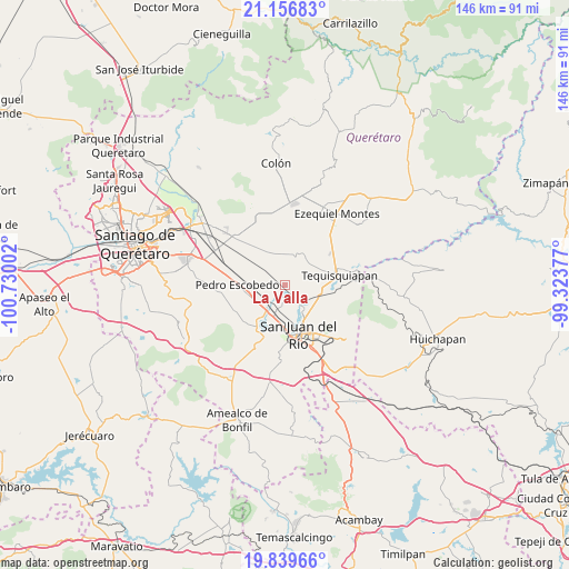
| Map corner | latitude | longitude |
|---|---|---|
| Upper-left | 21.15683°, | -100.73002° |
| Center: | 20.49966°, | -100.02689° |
| Lower-right: | 19.83966°, | -99.32377° |
| Map W x H: | 146.5×146.5 km | = 91×91mi |
| max Lat: | 32.7° ⇑32.2% North |
| La Valla: | 20.49966° |
| min Lat: | ⇓67.8% South 14.53588° |
| min Long | La Valla | max Long |
| -117.105° | -100.02689° | -86.73105° |
| W 35.7%⇐ | ⇒64.3% E |
Elevation
Elevation of La Valla is 1922 m = 6306 ft, and this is 668.3 m = 2193 ft above average elevation for this country.
| Max E: |
3497 m = 11473 ft | 30.1% |
| La Valla | 1922 m 6306 ft | |
| Avg. | 1253.7 m = 4113 ft | |
Min E: |
-1 m = -3 ft | 69.9% |
See also: Mexico elevation on elevation.city.
Geographical zone
La Valla is located in North Torrid zone (between Equator and Tropic of Cancer). Distance of this Northern Tropic circle is 326.6 km =202.9 mi to North.| Distance of | km | miles | from La Valla |
|---|---|---|---|
| North Pole | 7727.7 | 4801.8 | to North |
| Arctic Circle | 5121.8 | 3182.5 | to North |
| Tropic Cancer | 326.6 | 202.9 | to North |
| Equator | 2279.3 | 1416.3 | to South |


Nearby cities:
15 places around La Valla: (largest is in red/bold)
• El Organal
3.8 km =2.4 mi,  229°
229°
• El Saúz
9.5 km =5.9 mi,  255°
255°
• Fuentezuelas
7.8 km =4.8 mi,  36°
36°
• Ignacio Pérez
9.1 km =5.7 mi,  285°
285°
• La Fuente
6 km =3.7 mi,  350°
350°
• La Llave
5.1 km =3.2 mi,  137°
137°
• La Trinidad
6.9 km =4.3 mi,  75°
75°
• Laguna de Lourdes
3.2 km =2 mi,  224°
224°
• Los Cerritos
7.9 km =4.9 mi,  331°
331°
• Pueblo Quieto
8.6 km =5.3 mi, 135°
• San Clemente
6.2 km =3.9 mi, 285°
• San Germán
5.5 km =3.4 mi,  213°
213°
• San Javier
6.2 km =3.9 mi, 215°
• Santa Matilde
7.4 km =4.6 mi,  179°
179°
• Visthá
7.9 km =4.9 mi, 138°
Sources, notices
• [Note1] Compared only with cities in Mexico existing in our database
• [Src1] Map data: © OpenStreetMap contributors (CC-BY-SA)
• [Src2] Other city data from geonames.org with taken over terms of usage.
• [Src3] Geographical zone / Annual Mean Temperature by Robert A. Rohde @ Wikipedia
