Mesillas geodata
Mesillas (Querétaro) is a populated place; located in Mexico in America/Mexico_City (GMT-6) time zone. With population of 1,120 people, there are 7751 cities with bigger population in this country. Compared to other cities in Mexico, 59.9% of cities are located further ↓South; 64% of cities are located further →East and 89.7% of cities have lower elevation than Mesillas. Note1


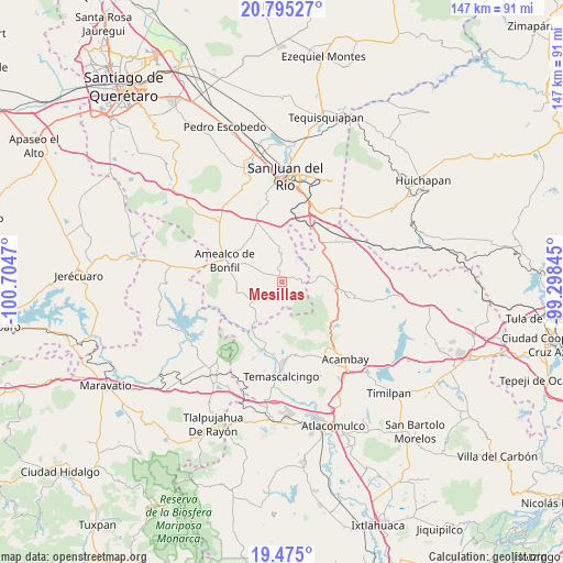
Mesillas GPS coordinates[2]
20° 8' 11.508" North, 100° 0' 5.652" West
| Map corner | latitude | longitude |
|---|---|---|
| Upper-left | 20.79527°, | -100.7047° |
| Center: | 20.13653°, | -100.00157° |
| Lower-right: | 19.475°, | -99.29845° |
| Map W x H: | 146.8×146.8 km | = 91.2×91.2mi |
| max Lat: | 32.7° ⇑40.1% North |
| Mesillas: | 20.13653° |
| min Lat: | ⇓59.9% South 14.53588° |
| min Long | Mesillas | max Long |
| -117.105° | -100.00157° | -86.73105° |
| W 36%⇐ | ⇒64% E |
Elevation
Elevation of Mesillas is 2397 m = 7864 ft, and this is 1143.3 m = 3751 ft above average elevation for this country.
| Max E: |
3497 m = 11473 ft | 10.3% |
| Mesillas | 2397 m 7864 ft | |
| Avg. | 1253.7 m = 4113 ft | |
Min E: |
-1 m = -3 ft | 89.7% |
See also: Mexico elevation on elevation.city.
Geographical zone
Mesillas is located in North Torrid zone (between Equator and Tropic of Cancer). Distance of this Northern Tropic circle is 366.9 km =228 mi to North.| Distance of | km | miles | from Mesillas |
|---|---|---|---|
| North Pole | 7768.1 | 4826.9 | to North |
| Arctic Circle | 5162.2 | 3207.6 | to North |
| Tropic Cancer | 366.9 | 228 | to North |
| Equator | 2239 | 1391.2 | to South |


Nearby cities:
15 places around Mesillas: (largest is in red/bold)
• Agostadero (San José Agostadero)
10.7 km =6.6 mi,  180°
180°
• El Mogote
9.7 km =6 mi,  70°
70°
• El Picacho
11.7 km =7.3 mi,  259°
259°
• La Concepción Pueblo
8.1 km =5 mi,  81°
81°
• La Ladera
6.3 km =3.9 mi,  267°
267°
• San Antonio Pueblo
9 km =5.6 mi,  104°
104°
• San Bartolomé del Pino
9 km =5.6 mi,  303°
303°
• San Francisco Shaxni Ejido
7.3 km =4.5 mi, 175°
• San Ildefonso Tultepec
4.5 km =2.8 mi, 79°
• San Lucas Totolmaloya
11.3 km =7 mi, 74°
• San Pablo
5.9 km =3.7 mi,  155°
155°
• San Pedro Denxhi Segundo Cuartel
10.9 km =6.8 mi,  23°
23°
• Santiago Mexquititlán Barrio 4to.
10.7 km =6.6 mi,  220°
220°
• Tenasdá (Barrio de San Ildefonso)
4.3 km =2.7 mi,  125°
125°
• Yosphí
6.4 km =4 mi,  53°
53°
Sources, notices
• [Note1] Compared only with cities in Mexico existing in our database
• [Src1] Map data: © OpenStreetMap contributors (CC-BY-SA)
• [Src2] Other city data from geonames.org with taken over terms of usage.
• [Src3] Geographical zone / Annual Mean Temperature by Robert A. Rohde @ Wikipedia
