Ojo de Agua geodata
Ojo de Agua (State of Mexico) is a populated place; located in Mexico in America/Mexico_City (GMT-6) time zone. With population of 2,083 people, there are 4192 cities with bigger population in this country. Compared to other cities in Mexico, 60.8% of cities are located further ↑North; 61.1% of cities are located further →East and 99.8% of cities have lower elevation than Ojo de Agua. Note1


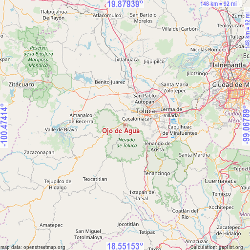
Ojo de Agua GPS coordinates[2]
19° 13' 0.48" North, 99° 46' 15.636" West
| Map corner | latitude | longitude |
|---|---|---|
| Upper-left | 19.87939°, | -100.47414° |
| Center: | 19.2168°, | -99.77101° |
| Lower-right: | 18.55153°, | -99.06789° |
| Map W x H: | 147.6×147.6 km | = 91.7×91.7mi |
| max Lat: | 32.7° ⇑60.8% North |
| Ojo de Agua: | 19.2168° |
| min Lat: | ⇓39.2% South 14.53588° |
| min Long | Ojo de Agua | max Long |
| -117.105° | -99.77101° | -86.73105° |
| W 38.9%⇐ | ⇒61.1% E |
Elevation
Elevation of Ojo de Agua is 3020 m = 9908 ft, and this is 1766.3 m = 5795 ft above average elevation for this country.
| Max E: |
3497 m = 11473 ft | 0.2% |
| Ojo de Agua | 3020 m 9908 ft | |
| Avg. | 1253.7 m = 4113 ft | |
Min E: |
-1 m = -3 ft | 99.8% |
See also: Mexico elevation on elevation.city.
Geographical zone
Ojo de Agua is located in North Torrid zone (between Equator and Tropic of Cancer). Distance of this Northern Tropic circle is 469.2 km =291.5 mi to North.| Distance of | km | miles | from Ojo de Agua |
|---|---|---|---|
| North Pole | 7870.4 | 4890.4 | to North |
| Arctic Circle | 5264.5 | 3271.2 | to North |
| Tropic Cancer | 469.2 | 291.5 | to North |
| Equator | 2136.7 | 1327.7 | to South |


Nearby cities:
15 places around Ojo de Agua: (largest is in red/bold)
• Buenavista
5.8 km =3.6 mi,  256°
256°
• Cerro La Calera
6.1 km =3.8 mi,  232°
232°
• Ciendabajo (Hacienda de Abajo)
6.6 km =4.1 mi,  349°
349°
• Colonia Cuauhtémoc
4.7 km =2.9 mi,  324°
324°
• Colonia Morelos
4.2 km =2.6 mi,  38°
38°
• Colonia Ricardo Flores Magón
5.9 km =3.7 mi,  13°
13°
• El Contadero de Matamoros
4.7 km =2.9 mi,  299°
299°
• La Joya
6.7 km =4.2 mi, 10°
• Loma Alta
6.2 km =3.9 mi,  217°
217°
• Recibitas (El Remolino)
2.2 km =1.4 mi,  32°
32°
• San Antonio Acahualco
6.4 km =4 mi,  359°
359°
• San Juan de las Huertas
3.7 km =2.3 mi,  21°
21°
• San Pedro Tejalpa
5.1 km =3.2 mi,  334°
334°
• Santa Cruz Cuauhtenco
5.7 km =3.5 mi,  50°
50°
• Tejalpa
3.9 km =2.4 mi, 8°
Sources, notices
• [Note1] Compared only with cities in Mexico existing in our database
• [Src1] Map data: © OpenStreetMap contributors (CC-BY-SA)
• [Src2] Other city data from geonames.org with taken over terms of usage.
• [Src3] Geographical zone / Annual Mean Temperature by Robert A. Rohde @ Wikipedia
