Barrio el Ocote geodata
Barrio el Ocote (State of Mexico) is a populated place; located in Mexico in America/Mexico_City (GMT-6) time zone. With population of 799 people, there are 10920 cities with bigger population in this country. Compared to other cities in Mexico, 54.8% of cities are located further ↑North; 63.2% of cities are located further →East and 95.8% of cities have lower elevation than Barrio el Ocote. Note1


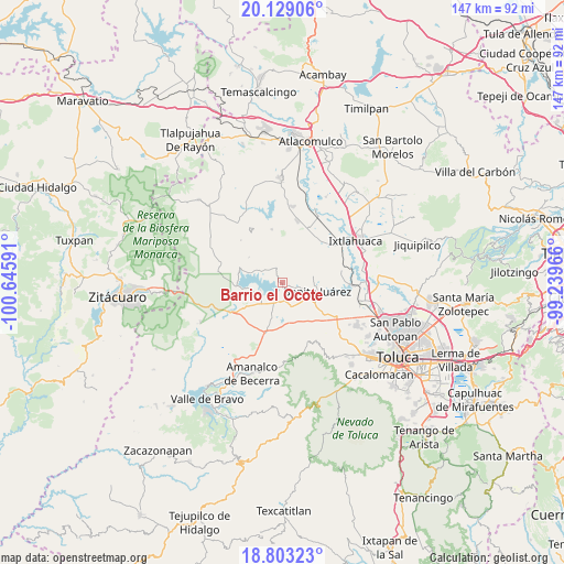
Barrio el Ocote GPS coordinates[2]
19° 28' 3" North, 99° 56' 34.008" West
| Map corner | latitude | longitude |
|---|---|---|
| Upper-left | 20.12906°, | -100.64591° |
| Center: | 19.4675°, | -99.94278° |
| Lower-right: | 18.80323°, | -99.23966° |
| Map W x H: | 147.4×147.4 km | = 91.6×91.6mi |
| max Lat: | 32.7° ⇑54.8% North |
| Barrio el Ocote: | 19.4675° |
| min Lat: | ⇓45.2% South 14.53588° |
| min Long | Barrio el Ocote | max Long |
| -117.105° | -99.94278° | -86.73105° |
| W 36.8%⇐ | ⇒63.2% E |
Elevation
Elevation of Barrio el Ocote is 2617 m = 8586 ft, and this is 1363.3 m = 4473 ft above average elevation for this country.
| Max E: |
3497 m = 11473 ft | 4.2% |
| Barrio el Ocote | 2617 m 8586 ft | |
| Avg. | 1253.7 m = 4113 ft | |
Min E: |
-1 m = -3 ft | 95.8% |
See also: Mexico elevation on elevation.city.
Geographical zone
Barrio el Ocote is located in North Torrid zone (between Equator and Tropic of Cancer). Distance of this Northern Tropic circle is 441.3 km =274.2 mi to North.| Distance of | km | miles | from Barrio el Ocote |
|---|---|---|---|
| North Pole | 7842.5 | 4873.1 | to North |
| Arctic Circle | 5236.6 | 3253.9 | to North |
| Tropic Cancer | 441.3 | 274.2 | to North |
| Equator | 2164.6 | 1345 | to South |


Nearby cities:
15 places around Barrio el Ocote: (largest is in red/bold)
• Barrio de San Isidro
6.2 km =3.9 mi,  344°
344°
• Barrio de San Miguel
5.1 km =3.2 mi,  345°
345°
• Casa Nueva (Casa Nueva Yebuciví)
3.8 km =2.4 mi,  47°
47°
• Hospital Propiedad (Dos Estrellas)
5 km =3.1 mi,  185°
185°
• La Alameda
6 km =3.7 mi,  322°
322°
• La Campanilla
4.7 km =2.9 mi,  0°
0°
• Las Peñas
6.3 km =3.9 mi,  251°
251°
• Mextepec
5.4 km =3.4 mi,  97°
97°
• Piedras Blancas (Piedras Blancas Centro)
6.6 km =4.1 mi,  7°
7°
• Río Frío (Río Frío Yebuciví)
5.1 km =3.2 mi,  16°
16°
• San Marcos de la Loma
4.2 km =2.6 mi,  333°
333°
• San Roque
2.3 km =1.4 mi,  307°
307°
• Sitio Ejido
4.7 km =2.9 mi,  109°
109°
• Venta de Ocotillos
1.7 km =1.1 mi,  284°
284°
• Villa Victoria
6.5 km =4 mi,  238°
238°
Sources, notices
• [Note1] Compared only with cities in Mexico existing in our database
• [Src1] Map data: © OpenStreetMap contributors (CC-BY-SA)
• [Src2] Other city data from geonames.org with taken over terms of usage.
• [Src3] Geographical zone / Annual Mean Temperature by Robert A. Rohde @ Wikipedia
