Mina Vieja geodata
Mina Vieja (State of Mexico) is a populated place; located in Mexico in America/Mexico_City (GMT-6) time zone. With population of 1,771 people, there are 4902 cities with bigger population in this country. Compared to other cities in Mexico, 53% of cities are located further ↑North; 63.2% of cities are located further →East and 99.5% of cities have lower elevation than Mina Vieja. Note1


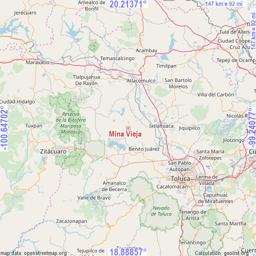
Mina Vieja GPS coordinates[2]
19° 33' 9" North, 99° 56' 38.004" West
| Map corner | latitude | longitude |
|---|---|---|
| Upper-left | 20.21371°, | -100.64702° |
| Center: | 19.5525°, | -99.94389° |
| Lower-right: | 18.88857°, | -99.24077° |
| Map W x H: | 147.3×147.3 km | = 91.5×91.5mi |
| max Lat: | 32.7° ⇑53% North |
| Mina Vieja: | 19.5525° |
| min Lat: | ⇓47% South 14.53588° |
| min Long | Mina Vieja | max Long |
| -117.105° | -99.94389° | -86.73105° |
| W 36.8%⇐ | ⇒63.2% E |
Elevation
Elevation of Mina Vieja is 2902 m = 9521 ft, and this is 1648.3 m = 5408 ft above average elevation for this country.
| Max E: |
3497 m = 11473 ft | 0.5% |
| Mina Vieja | 2902 m 9521 ft | |
| Avg. | 1253.7 m = 4113 ft | |
Min E: |
-1 m = -3 ft | 99.5% |
See also: Mexico elevation on elevation.city.
Geographical zone
Mina Vieja is located in North Torrid zone (between Equator and Tropic of Cancer). Distance of this Northern Tropic circle is 431.9 km =268.4 mi to North.| Distance of | km | miles | from Mina Vieja |
|---|---|---|---|
| North Pole | 7833 | 4867.2 | to North |
| Arctic Circle | 5227.1 | 3248 | to North |
| Tropic Cancer | 431.9 | 268.4 | to North |
| Equator | 2174 | 1350.9 | to South |


Nearby cities:
15 places around Mina Vieja: (largest is in red/bold)
• Barrio de Centro del Cerrillo
2 km =1.2 mi,  211°
211°
• Barrio de Puentecillas
4.7 km =2.9 mi,  246°
246°
• Barrio de San Isidro
3.8 km =2.4 mi,  204°
204°
• Barrio de San Miguel
4.6 km =2.9 mi,  194°
194°
• Fresno Nichi
1.7 km =1.1 mi,  341°
341°
• La Alameda
5.9 km =3.7 mi,  216°
216°
• La Campanilla
4.7 km =2.9 mi,  177°
177°
• La Guadalupana
3.6 km =2.2 mi,  87°
87°
• Palos Amarillos (Palos Amarillos Yebuciví)
3.2 km =2 mi,  116°
116°
• Piedras Blancas (Piedras Blancas Centro)
3 km =1.9 mi,  162°
162°
• Río Frío (Río Frío Yebuciví)
4.9 km =3 mi, 161°
• San Antonio de las Huertas
3 km =1.9 mi,  290°
290°
• San Jerónimo Mavatí
5.8 km =3.6 mi,  358°
358°
• San Marcos de la Loma
6 km =3.7 mi, 196°
• Santa Ana Nichi Ejido
5.9 km =3.7 mi,  306°
306°
Sources, notices
• [Note1] Compared only with cities in Mexico existing in our database
• [Src1] Map data: © OpenStreetMap contributors (CC-BY-SA)
• [Src2] Other city data from geonames.org with taken over terms of usage.
• [Src3] Geographical zone / Annual Mean Temperature by Robert A. Rohde @ Wikipedia
