Barrio de San Miguel geodata
Barrio de San Miguel (State of Mexico) is a populated place; located in Mexico in America/Mexico_City (GMT-6) time zone. With population of 1,074 people, there are 8122 cities with bigger population in this country. Compared to other cities in Mexico, 53.8% of cities are located further ↑North; 63.4% of cities are located further →East and 97.9% of cities have lower elevation than Barrio de San Miguel. Note1


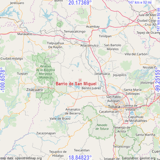
Barrio de San Miguel GPS coordinates[2]
19° 30' 44.352" North, 99° 57' 16.812" West
| Map corner | latitude | longitude |
|---|---|---|
| Upper-left | 20.17369°, | -100.6578° |
| Center: | 19.51232°, | -99.95467° |
| Lower-right: | 18.84823°, | -99.25155° |
| Map W x H: | 147.4×147.4 km | = 91.6×91.6mi |
| max Lat: | 32.7° ⇑53.8% North |
| Barrio de San Miguel: | 19.51232° |
| min Lat: | ⇓46.2% South 14.53588° |
| min Long | Barrio de San M | max Long |
| -117.105° | -99.95467° | -86.73105° |
| W 36.6%⇐ | ⇒63.4% E |
Elevation
Elevation of Barrio de San Miguel is 2737 m = 8980 ft, and this is 1483.3 m = 4866 ft above average elevation for this country.
| Max E: |
3497 m = 11473 ft | 2.1% |
| Barrio de San Miguel | 2737 m 8980 ft | |
| Avg. | 1253.7 m = 4113 ft | |
Min E: |
-1 m = -3 ft | 97.9% |
See also: Mexico elevation on elevation.city.
Geographical zone
Barrio de San Miguel is located in North Torrid zone (between Equator and Tropic of Cancer). Distance of this Northern Tropic circle is 436.4 km =271.2 mi to North.| Distance of | km | miles | from Barrio de San Miguel |
|---|---|---|---|
| North Pole | 7837.5 | 4870 | to North |
| Arctic Circle | 5231.6 | 3250.8 | to North |
| Tropic Cancer | 436.4 | 271.2 | to North |
| Equator | 2169.6 | 1348.1 | to South |


Nearby cities:
15 places around Barrio de San Miguel: (largest is in red/bold)
• Barrio de Centro del Cerrillo
2.7 km =1.7 mi,  1°
1°
• Barrio de Puentecillas
4.1 km =2.5 mi,  309°
309°
• Barrio de San Isidro
1.1 km =0.7 mi,  337°
337°
• Barrio el Centenario
4.3 km =2.7 mi,  278°
278°
• Casa Nueva (Casa Nueva Yebuciví)
4.7 km =2.9 mi,  121°
121°
• Cuadrilla Vieja
3.4 km =2.1 mi,  269°
269°
• La Alameda
2.4 km =1.5 mi,  263°
263°
• La Campanilla
1.3 km =0.8 mi,  102°
102°
• Loma de Guadalupe
4.9 km =3 mi, 266°
• Mina Vieja
4.6 km =2.9 mi,  14°
14°
• Piedras Blancas (Piedras Blancas Centro)
2.6 km =1.6 mi,  52°
52°
• Río Frío (Río Frío Yebuciví)
2.7 km =1.7 mi,  92°
92°
• San Marcos de la Loma
1.4 km =0.9 mi,  205°
205°
• San Roque
3.6 km =2.2 mi,  189°
189°
• Venta de Ocotillos
4.6 km =2.9 mi, 185°
Sources, notices
• [Note1] Compared only with cities in Mexico existing in our database
• [Src1] Map data: © OpenStreetMap contributors (CC-BY-SA)
• [Src2] Other city data from geonames.org with taken over terms of usage.
• [Src3] Geographical zone / Annual Mean Temperature by Robert A. Rohde @ Wikipedia
