La Providencia geodata
La Providencia (State of Mexico) is a populated place; located in Mexico in America/Mexico_City (GMT-6) time zone. With population of 946 people, there are 9202 cities with bigger population in this country. Compared to other cities in Mexico, 50.4% of cities are located further ↓South; 60.9% of cities are located further →East and 97.5% of cities have lower elevation than La Providencia. Note1


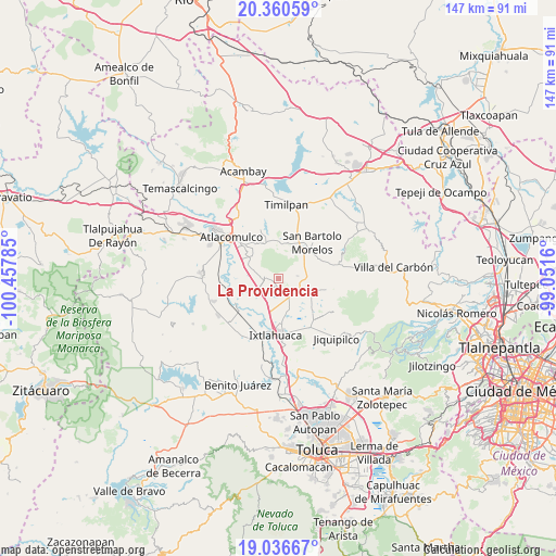
La Providencia GPS coordinates[2]
19° 42' 0" North, 99° 45' 16.992" West
| Map corner | latitude | longitude |
|---|---|---|
| Upper-left | 20.36059°, | -100.45785° |
| Center: | 19.7°, | -99.75472° |
| Lower-right: | 19.03667°, | -99.0516° |
| Map W x H: | 147.2×147.2 km | = 91.5×91.5mi |
| max Lat: | 32.7° ⇑49.6% North |
| La Providencia: | 19.7° |
| min Lat: | ⇓50.4% South 14.53588° |
| min Long | La Providencia | max Long |
| -117.105° | -99.75472° | -86.73105° |
| W 39.1%⇐ | ⇒60.9% E |
Elevation
Elevation of La Providencia is 2712 m = 8898 ft, and this is 1458.3 m = 4784 ft above average elevation for this country.
| Max E: |
3497 m = 11473 ft | 2.5% |
| La Providencia | 2712 m 8898 ft | |
| Avg. | 1253.7 m = 4113 ft | |
Min E: |
-1 m = -3 ft | 97.5% |
See also: Mexico elevation on elevation.city.
Geographical zone
La Providencia is located in North Torrid zone (between Equator and Tropic of Cancer). Distance of this Northern Tropic circle is 415.5 km =258.2 mi to North.| Distance of | km | miles | from La Providencia |
|---|---|---|---|
| North Pole | 7816.6 | 4857 | to North |
| Arctic Circle | 5210.7 | 3237.8 | to North |
| Tropic Cancer | 415.5 | 258.2 | to North |
| Equator | 2190.4 | 1361.1 | to South |


Nearby cities:
15 places around La Providencia: (largest is in red/bold)
• Barrio de Guadalupe
6.7 km =4.2 mi,  251°
251°
• Barrio de San Joaquín
6.4 km =4 mi,  241°
241°
• Barrio de la Luz
4.5 km =2.8 mi,  69°
69°
• Barrio el Lindero
5.7 km =3.5 mi,  55°
55°
• Barrio la Tenería
4 km =2.5 mi,  259°
259°
• El Progreso
2 km =1.2 mi, 260°
• Huemetla
2.6 km =1.6 mi,  49°
49°
• Jocotitlán
3.7 km =2.3 mi,  287°
287°
• Los Reyes
1.9 km =1.2 mi,  211°
211°
• Meje
5.9 km =3.7 mi,  96°
96°
• San Francisco Chejé
2.3 km =1.4 mi,  164°
164°
• San José Boqui
2.7 km =1.7 mi,  86°
86°
• Santa María Endare
7 km =4.3 mi, 293°
• Santiago Yeché
4.6 km =2.9 mi,  78°
78°
• Tiacaque
5.3 km =3.3 mi,  124°
124°
Sources, notices
• [Note1] Compared only with cities in Mexico existing in our database
• [Src1] Map data: © OpenStreetMap contributors (CC-BY-SA)
• [Src2] Other city data from geonames.org with taken over terms of usage.
• [Src3] Geographical zone / Annual Mean Temperature by Robert A. Rohde @ Wikipedia
