San José Comalco geodata
San José Comalco (Morelos) is a populated place; located in Mexico in America/Mexico_City (GMT-6) time zone. With population of 1,955 people, there are 4454 cities with bigger population in this country. Compared to other cities in Mexico, 54.7% of cities are located further ↑North; 59% of cities are located further →East and 94.9% of cities have lower elevation than San José Comalco. Note1


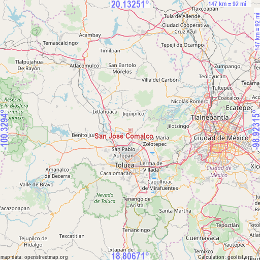
San José Comalco GPS coordinates[2]
19° 28' 15.492" North, 99° 37' 34.572" West
| Map corner | latitude | longitude |
|---|---|---|
| Upper-left | 20.13251°, | -100.3294° |
| Center: | 19.47097°, | -99.62627° |
| Lower-right: | 18.80671°, | -98.92315° |
| Map W x H: | 147.4×147.4 km | = 91.6×91.6mi |
| max Lat: | 32.7° ⇑54.7% North |
| San José Comalco: | 19.47097° |
| min Lat: | ⇓45.3% South 14.53588° |
| min Long | San José Comal | max Long |
| -117.105° | -99.62627° | -86.73105° |
| W 41%⇐ | ⇒59% E |
Elevation
Elevation of San José Comalco is 2594 m = 8510 ft, and this is 1340.3 m = 4397 ft above average elevation for this country.
| Max E: |
3497 m = 11473 ft | 5.1% |
| San José Comalco | 2594 m 8510 ft | |
| Avg. | 1253.7 m = 4113 ft | |
Min E: |
-1 m = -3 ft | 94.9% |
See also: Mexico elevation on elevation.city.
Geographical zone
San José Comalco is located in North Torrid zone (between Equator and Tropic of Cancer). Distance of this Northern Tropic circle is 441 km =274 mi to North.| Distance of | km | miles | from San José Comalco |
|---|---|---|---|
| North Pole | 7842.1 | 4872.9 | to North |
| Arctic Circle | 5236.2 | 3253.6 | to North |
| Tropic Cancer | 441 | 274 | to North |
| Equator | 2165 | 1345.3 | to South |


Nearby cities:
15 places around San José Comalco: (largest is in red/bold)
• Calle Real
2.4 km =1.5 mi,  34°
34°
• Cerrito del Panal
3.5 km =2.2 mi, 25°
• Ejido de Dolores
4.7 km =2.9 mi,  162°
162°
• La Cañada
3.3 km =2.1 mi,  59°
59°
• La Magdalena Tenexpan
4 km =2.5 mi,  102°
102°
• Loma Alta
2.6 km =1.6 mi, 64°
• Loma de San Nicolás
4 km =2.5 mi,  147°
147°
• Molino Abajo
3.5 km =2.2 mi,  133°
133°
• Pothé
2.5 km =1.6 mi,  81°
81°
• San Diego Alcalá
2.3 km =1.4 mi,  166°
166°
• San José Pathé
4 km =2.5 mi,  187°
187°
• Silverio Galicia García
2.6 km =1.6 mi, 169°
• Temoaya
3.4 km =2.1 mi, 96°
• Tlachaloya
4.5 km =2.8 mi,  236°
236°
• Tlaltenango Arriba
3.3 km =2.1 mi,  87°
87°
Sources, notices
• [Note1] Compared only with cities in Mexico existing in our database
• [Src1] Map data: © OpenStreetMap contributors (CC-BY-SA)
• [Src2] Other city data from geonames.org with taken over terms of usage.
• [Src3] Geographical zone / Annual Mean Temperature by Robert A. Rohde @ Wikipedia
