San Pedro Tlaltizapan geodata
San Pedro Tlaltizapan (Morelos) is a populated place; located in Mexico in America/Mexico_City (GMT-6) time zone. With population of 11,472 people, there are 839 cities with bigger population in this country. Compared to other cities in Mexico, 61.2% of cities are located further ↑North; 56.9% of cities are located further →East and 94.3% of cities have lower elevation than San Pedro Tlaltizapan. Note1
Current local time in San Pedro Tlaltizapan:
04:45 AM, WednesdayDifference from your time zone: hours


San Pedro Tlaltizapan GPS coordinates[2]
19° 11' 59.028" North, 99° 29' 58.416" West
| Map corner | latitude | longitude |
|---|---|---|
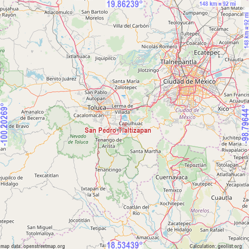
| Upper-left | 19.86239°, | -100.20269° |
| Center: | 19.19973°, | -99.49956° |
| Lower-right: | 18.53439°, | -98.79644° |
| Map W x H: | 147.7×147.7 km | = 91.8×91.8mi |
| max Lat: | 32.7° ⇑61.2% North |
| San Pedro Tlaltizapan: | 19.19973° |
| min Lat: | ⇓38.8% South 14.53588° |
| min Long | San Pedro Tlalt | max Long |
| -117.105° | -99.49956° | -86.73105° |
| W 43.1%⇐ | ⇒56.9% E |
Elevation
Elevation of San Pedro Tlaltizapan is 2580 m = 8465 ft, and this is 1326.3 m = 4351 ft above average elevation for this country.
| Max E: |
3497 m = 11473 ft | 5.7% |
| San Pedro Tlaltizapan | 2580 m 8465 ft | |
| Avg. | 1253.7 m = 4113 ft | |
Min E: |
-1 m = -3 ft | 94.3% |
See also: Mexico elevation on elevation.city.
Geographical zone
San Pedro Tlaltizapan is located in North Torrid zone (between Equator and Tropic of Cancer). Distance of this Northern Tropic circle is 471.1 km =292.7 mi to North.| Distance of | km | miles | from San Pedro Tlaltizapan |
|---|---|---|---|
| North Pole | 7872.3 | 4891.6 | to North |
| Arctic Circle | 5266.4 | 3272.4 | to North |
| Tropic Cancer | 471.1 | 292.7 | to North |
| Equator | 2134.8 | 1326.5 | to South |


Nearby cities:
15 places around San Pedro Tlaltizapan: (largest is in red/bold)
• Agua Blanca
3.8 km =2.4 mi,  52°
52°
• Almoloya del Río
4.5 km =2.8 mi,  163°
163°
• Capulhuac de Mirafuentes
3.6 km =2.2 mi,  101°
101°
• Colonia el Pirame
5.4 km =3.4 mi,  32°
32°
• Colonia la Libertad
1.6 km =1 mi,  191°
191°
• Colonia la Poza
2.2 km =1.4 mi,  90°
90°
• Colonia la Presa (Ejido de Chapultepec)
4.7 km =2.9 mi,  271°
271°
• Colonia las Granjas
5.5 km =3.4 mi,  113°
113°
• Lomas de San Juan
4 km =2.5 mi,  74°
74°
• San Juan Bautista
4.5 km =2.8 mi, 88°
• San Mateo Texcalyacac
5 km =3.1 mi,  136°
136°
• San Nicolás Tlazala
4.8 km =3 mi, 51°
• Santa Cruz Atizapán
2.8 km =1.7 mi, 155°
• Santa Cruz Tultepec
4.3 km =2.7 mi,  44°
44°
• Santiago Tianguistenco de Galeana
4.1 km =2.5 mi,  121°
121°
Sources, notices
• [Note1] Compared only with cities in Mexico existing in our database
• [Src1] Map data: © OpenStreetMap contributors (CC-BY-SA)
• [Src2] Other city data from geonames.org with taken over terms of usage.
• [Src3] Geographical zone / Annual Mean Temperature by Robert A. Rohde @ Wikipedia
