La Loma geodata
La Loma (Hidalgo) is a populated place; located in Mexico in America/Mexico_City (GMT-6) time zone. With population of 571 people, there are 14980 cities with bigger population in this country. Compared to other cities in Mexico, 52.6% of cities are located further ↓South; 55% of cities are located further →East and 87.8% of cities have lower elevation than La Loma. Note1


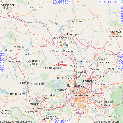
La Loma GPS coordinates[2]
19° 47' 36.204" North, 99° 21' 15.048" West
| Map corner | latitude | longitude |
|---|---|---|
| Upper-left | 20.45359°, | -100.05731° |
| Center: | 19.79339°, | -99.35418° |
| Lower-right: | 19.13044°, | -98.65106° |
| Map W x H: | 147.1×147.1 km | = 91.4×91.4mi |
| max Lat: | 32.7° ⇑47.4% North |
| La Loma: | 19.79339° |
| min Lat: | ⇓52.6% South 14.53588° |
| min Long | La Loma | max Long |
| -117.105° | -99.35418° | -86.73105° |
| W 45%⇐ | ⇒55% E |
Elevation
Elevation of La Loma is 2335 m = 7661 ft, and this is 1081.3 m = 3548 ft above average elevation for this country.
| Max E: |
3497 m = 11473 ft | 12.2% |
| La Loma | 2335 m 7661 ft | |
| Avg. | 1253.7 m = 4113 ft | |
Min E: |
-1 m = -3 ft | 87.8% |
See also: Mexico elevation on elevation.city.
Geographical zone
La Loma is located in North Torrid zone (between Equator and Tropic of Cancer). Distance of this Northern Tropic circle is 405.1 km =251.7 mi to North.| Distance of | km | miles | from La Loma |
|---|---|---|---|
| North Pole | 7806.2 | 4850.5 | to North |
| Arctic Circle | 5200.4 | 3231.4 | to North |
| Tropic Cancer | 405.1 | 251.7 | to North |
| Equator | 2200.8 | 1367.5 | to South |


Nearby cities:
15 places around La Loma: (largest is in red/bold)
• Cantera de Villagrán
7.1 km =4.4 mi,  41°
41°
• Cañada de Cisneros
11.1 km =6.9 mi,  169°
169°
• La Cruz y Carrizal
8.2 km =5.1 mi,  300°
300°
• Loma Alta Taxhimay
7.8 km =4.8 mi,  313°
313°
• San Buenaventura
4.5 km =2.8 mi,  47°
47°
• San Ignacio Nopala
4.7 km =2.9 mi,  10°
10°
• San José Piedra Gorda
1.4 km =0.9 mi,  333°
333°
• San Luis Anáhuac (Toriles)
4.8 km =3 mi,  274°
274°
• San Luis Taxhimay
6.9 km =4.3 mi,  317°
317°
• San Miguel Cañadas
8 km =5 mi, 173°
• Santa Gertrudis
6.8 km =4.2 mi,  191°
191°
• Santa María Quelites
6.8 km =4.2 mi, 5°
• Santiago Tlapanaloya
8.6 km =5.3 mi,  2°
2°
• Taxhido
10.4 km =6.5 mi, 0°
• Unidad San Miguel Jagüeyes
7.6 km =4.7 mi,  63°
63°
Sources, notices
• [Note1] Compared only with cities in Mexico existing in our database
• [Src1] Map data: © OpenStreetMap contributors (CC-BY-SA)
• [Src2] Other city data from geonames.org with taken over terms of usage.
• [Src3] Geographical zone / Annual Mean Temperature by Robert A. Rohde @ Wikipedia
