San José Acoculco geodata
San José Acoculco (Hidalgo) is a populated place; located in Mexico in America/Mexico_City (GMT-6) time zone. With population of 688 people, there are 12631 cities with bigger population in this country. Compared to other cities in Mexico, 56.4% of cities are located further ↓South; 54.2% of cities are located further →East and 80.2% of cities have lower elevation than San José Acoculco. Note1


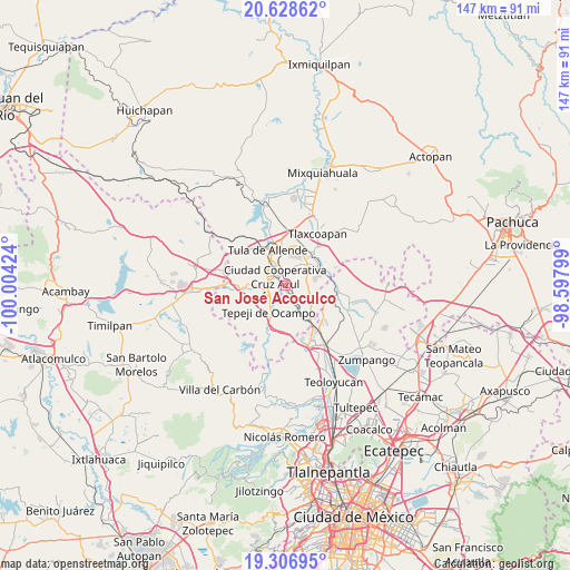
San José Acoculco GPS coordinates[2]
19° 58' 9.012" North, 99° 18' 3.996" West
| Map corner | latitude | longitude |
|---|---|---|
| Upper-left | 20.62862°, | -100.00424° |
| Center: | 19.96917°, | -99.30111° |
| Lower-right: | 19.30695°, | -98.59799° |
| Map W x H: | 147×147 km | = 91.3×91.3mi |
| max Lat: | 32.7° ⇑43.6% North |
| San José Acoculco: | 19.96917° |
| min Lat: | ⇓56.4% South 14.53588° |
| min Long | San José Acocu | max Long |
| -117.105° | -99.30111° | -86.73105° |
| W 45.8%⇐ | ⇒54.2% E |
Elevation
Elevation of San José Acoculco is 2145 m = 7037 ft, and this is 891.3 m = 2924 ft above average elevation for this country.
| Max E: |
3497 m = 11473 ft | 19.8% |
| San José Acoculco | 2145 m 7037 ft | |
| Avg. | 1253.7 m = 4113 ft | |
Min E: |
-1 m = -3 ft | 80.2% |
See also: Mexico elevation on elevation.city.
Geographical zone
San José Acoculco is located in North Torrid zone (between Equator and Tropic of Cancer). Distance of this Northern Tropic circle is 385.6 km =239.6 mi to North.| Distance of | km | miles | from San José Acoculco |
|---|---|---|---|
| North Pole | 7786.7 | 4838.4 | to North |
| Arctic Circle | 5180.8 | 3219.2 | to North |
| Tropic Cancer | 385.6 | 239.6 | to North |
| Equator | 2220.4 | 1379.7 | to South |


Nearby cities:
15 places around San José Acoculco: (largest is in red/bold)
• Bomintzha
5.8 km =3.6 mi,  30°
30°
• Colonia Nueva Santa María
6.1 km =3.8 mi,  301°
301°
• Colonia Sesenta y Dos
6.2 km =3.9 mi,  310°
310°
• Conejos
6.1 km =3.8 mi,  83°
83°
• Ignacio Zaragoza
5.6 km =3.5 mi,  338°
338°
• La Amistad
4.8 km =3 mi, 335°
• Melchor Ocampo
3.3 km =2.1 mi,  142°
142°
• Monte Alegre
4.5 km =2.8 mi,  289°
289°
• San Antonio
2.3 km =1.4 mi, 138°
• San Lucas Teacalco
6.3 km =3.9 mi,  281°
281°
• San Miguel Vindho
3.3 km =2.1 mi,  328°
328°
• Santa María Ilucan
4.8 km =3 mi, 302°
• Tianguistengo (La Romera)
6.6 km =4.1 mi,  202°
202°
• Unidad Obrera Habitacional CTM
5.4 km =3.4 mi, 201°
• Zacamulpa
6.2 km =3.9 mi,  48°
48°
Sources, notices
• [Note1] Compared only with cities in Mexico existing in our database
• [Src1] Map data: © OpenStreetMap contributors (CC-BY-SA)
• [Src2] Other city data from geonames.org with taken over terms of usage.
• [Src3] Geographical zone / Annual Mean Temperature by Robert A. Rohde @ Wikipedia
