San Miguel Vindho geodata
San Miguel Vindho (Hidalgo) is a populated place; located in Mexico in America/Mexico_City (GMT-6) time zone. With population of 7,988 people, there are 1184 cities with bigger population in this country. Compared to other cities in Mexico, 56.9% of cities are located further ↓South; 54.3% of cities are located further →East and 79.7% of cities have lower elevation than San Miguel Vindho. Note1


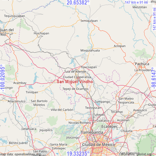
San Miguel Vindho GPS coordinates[2]
19° 59' 40.092" North, 99° 19' 4.152" West
| Map corner | latitude | longitude |
|---|---|---|
| Upper-left | 20.65382°, | -100.02095° |
| Center: | 19.99447°, | -99.31782° |
| Lower-right: | 19.33235°, | -98.6147° |
| Map W x H: | 146.9×146.9 km | = 91.3×91.3mi |
| max Lat: | 32.7° ⇑43.1% North |
| San Miguel Vindho: | 19.99447° |
| min Lat: | ⇓56.9% South 14.53588° |
| min Long | San Miguel Vind | max Long |
| -117.105° | -99.31782° | -86.73105° |
| W 45.7%⇐ | ⇒54.3% E |
Elevation
Elevation of San Miguel Vindho is 2134 m = 7001 ft, and this is 880.3 m = 2888 ft above average elevation for this country.
| Max E: |
3497 m = 11473 ft | 20.3% |
| San Miguel Vindho | 2134 m 7001 ft | |
| Avg. | 1253.7 m = 4113 ft | |
Min E: |
-1 m = -3 ft | 79.7% |
See also: Mexico elevation on elevation.city.
Geographical zone
San Miguel Vindho is located in North Torrid zone (between Equator and Tropic of Cancer). Distance of this Northern Tropic circle is 382.7 km =237.8 mi to North.| Distance of | km | miles | from San Miguel Vindho |
|---|---|---|---|
| North Pole | 7783.9 | 4836.7 | to North |
| Arctic Circle | 5178 | 3217.5 | to North |
| Tropic Cancer | 382.7 | 237.8 | to North |
| Equator | 2223.2 | 1381.4 | to South |


Nearby cities:
15 places around San Miguel Vindho: (largest is in red/bold)
• Bomintzha
5.2 km =3.2 mi,  65°
65°
• Colonia Nueva Santa María
3.5 km =2.2 mi,  275°
275°
• Colonia Sesenta y Dos
3.2 km =2 mi,  292°
292°
• Ignacio Zaragoza
2.4 km =1.5 mi,  351°
351°
• La Amistad
1.6 km =1 mi, 350°
• Monte Alegre
2.8 km =1.7 mi,  241°
241°
• San Antonio
5.5 km =3.4 mi,  144°
144°
• San Ildefonso
5.7 km =3.5 mi,  272°
272°
• San José Acoculco
3.3 km =2.1 mi,  148°
148°
• San Lucas Teacalco
4.7 km =2.9 mi,  250°
250°
• San Marcos
4.4 km =2.7 mi,  335°
335°
• Santa María Ilucan
2.3 km =1.4 mi,  263°
263°
• Santa María Magdalena
6.3 km =3.9 mi, 248°
• Santiago Tlautla
6.4 km =4 mi, 236°
• Zacamulpa
6.5 km =4 mi,  78°
78°
Sources, notices
• [Note1] Compared only with cities in Mexico existing in our database
• [Src1] Map data: © OpenStreetMap contributors (CC-BY-SA)
• [Src2] Other city data from geonames.org with taken over terms of usage.
• [Src3] Geographical zone / Annual Mean Temperature by Robert A. Rohde @ Wikipedia
