Monte Alegre geodata
Monte Alegre (Hidalgo) is a populated place; located in Mexico in America/Mexico_City (GMT-6) time zone. With population of 1,521 people, there are 5668 cities with bigger population in this country. Compared to other cities in Mexico, 56.7% of cities are located further ↓South; 54.7% of cities are located further →East and 77.4% of cities have lower elevation than Monte Alegre. Note1


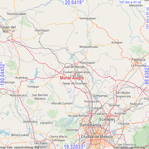
Monte Alegre GPS coordinates[2]
19° 58' 57" North, 99° 20' 29.004" West
| Map corner | latitude | longitude |
|---|---|---|
| Upper-left | 20.6419°, | -100.04452° |
| Center: | 19.9825°, | -99.34139° |
| Lower-right: | 19.32033°, | -98.63827° |
| Map W x H: | 146.9×146.9 km | = 91.3×91.3mi |
| max Lat: | 32.7° ⇑43.3% North |
| Monte Alegre: | 19.9825° |
| min Lat: | ⇓56.7% South 14.53588° |
| min Long | Monte Alegre | max Long |
| -117.105° | -99.34139° | -86.73105° |
| W 45.3%⇐ | ⇒54.7% E |
Elevation
Elevation of Monte Alegre is 2077 m = 6814 ft, and this is 823.3 m = 2701 ft above average elevation for this country.
| Max E: |
3497 m = 11473 ft | 22.6% |
| Monte Alegre | 2077 m 6814 ft | |
| Avg. | 1253.7 m = 4113 ft | |
Min E: |
-1 m = -3 ft | 77.4% |
See also: Mexico elevation on elevation.city.
Geographical zone
Monte Alegre is located in North Torrid zone (between Equator and Tropic of Cancer). Distance of this Northern Tropic circle is 384.1 km =238.7 mi to North.| Distance of | km | miles | from Monte Alegre |
|---|---|---|---|
| North Pole | 7785.2 | 4837.5 | to North |
| Arctic Circle | 5179.3 | 3218.3 | to North |
| Tropic Cancer | 384.1 | 238.7 | to North |
| Equator | 2221.8 | 1380.6 | to South |


Nearby cities:
15 places around Monte Alegre: (largest is in red/bold)
• Cañada de Madero
5.8 km =3.6 mi,  250°
250°
• Colonia Nueva Santa María
2 km =1.2 mi,  328°
328°
• Colonia Sesenta y Dos
2.6 km =1.6 mi,  349°
349°
• Ignacio Zaragoza
4.3 km =2.7 mi,  29°
29°
• La Amistad
3.6 km =2.2 mi,  37°
37°
• San Antonio
6.5 km =4 mi,  119°
119°
• San Ildefonso
3.5 km =2.2 mi,  295°
295°
• San José Acoculco
4.5 km =2.8 mi,  109°
109°
• San Lucas Teacalco
2 km =1.2 mi,  263°
263°
• San Marcos
5.4 km =3.4 mi,  6°
6°
• San Miguel Vindho
2.8 km =1.7 mi,  61°
61°
• Santa Ana Azcapotzaltongo
6.5 km =4 mi,  228°
228°
• Santa María Ilucan
1.1 km =0.7 mi, 10°
• Santa María Magdalena
3.5 km =2.2 mi, 254°
• Santiago Tlautla
3.7 km =2.3 mi, 232°
Sources, notices
• [Note1] Compared only with cities in Mexico existing in our database
• [Src1] Map data: © OpenStreetMap contributors (CC-BY-SA)
• [Src2] Other city data from geonames.org with taken over terms of usage.
• [Src3] Geographical zone / Annual Mean Temperature by Robert A. Rohde @ Wikipedia
