Bacame Nuevo geodata
Bacame Nuevo (Sonora) is a populated place; located in Mexico in America/Hermosillo (GMT-7) time zone. With population of 3,501 people, there are 2609 cities with bigger population in this country. Compared to other cities in Mexico, 96.5% of cities are located further ↓South; 97.6% of cities are located further →East and 84.1% of cities have higher elevation than Bacame Nuevo. Note1


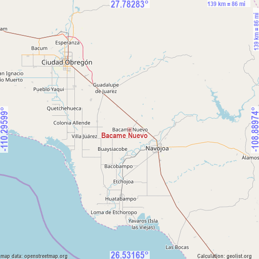
Bacame Nuevo GPS coordinates[2]
27° 9' 32.364" North, 109° 35' 34.296" West
| Map corner | latitude | longitude |
|---|---|---|
| Upper-left | 27.78283°, | -110.29599° |
| Center: | 27.15899°, | -109.59286° |
| Lower-right: | 26.53165°, | -108.88974° |
| Map W x H: | 139.1×139.1 km | = 86.4×86.4mi |
| max Lat: | 32.7° ⇑3.5% North |
| Bacame Nuevo: | 27.15899° |
| min Lat: | ⇓96.5% South 14.53588° |
| min Long | Bacame Nuevo | max Long |
| -117.105° | -109.59286° | -86.73105° |
| W 2.4%⇐ | ⇒97.6% E |
Elevation
Elevation of Bacame Nuevo is 51 m = 167 ft, and this is 1202.7 m = 3946 ft below average elevation for this country.
| Max E: |
3497 m = 11473 ft | 84.1% |
| Avg. | 1253.7 m = 4113 ft | |
| Bacame Nuevo | 51 m = 167 ft | |
Min E: |
-1 m = -3 ft | 15.9% |
See also: Mexico elevation on elevation.city.
Geographical zone
Bacame Nuevo is located in North temperate zone (between Tropic of Cancer and the Arctic Circle). Distance of this Northern Tropic circle is 413.9 km =257.2 mi to South.| Distance of | km | miles | from Bacame Nuevo |
|---|---|---|---|
| North Pole | 6987.3 | 4341.7 | to North |
| Arctic Circle | 4381.4 | 2722.5 | to North |
| Tropic Cancer | 413.9 | 257.2 | to South |
| Equator | 3019.8 | 1876.4 | to South |


Nearby cities:
15 places around Bacame Nuevo: (largest is in red/bold)
• Agua Blanca
14.9 km =9.3 mi,  250°
250°
• Aquichopo
9.7 km =6 mi,  160°
160°
• Buaysiacobe
13.7 km =8.5 mi,  222°
222°
• Capohuiza
14.6 km =9.1 mi,  101°
101°
• Chucarit
14.2 km =8.8 mi,  176°
176°
• El Recodo
11.2 km =7 mi,  144°
144°
• El Siviral (Jigica)
11.1 km =6.9 mi,  124°
124°
• Jitonhueca
10.9 km =6.8 mi,  186°
186°
• Loma del Refugio
13.9 km =8.6 mi,  107°
107°
• Los Bahuises
13.3 km =8.3 mi, 110°
• Navolato
14.1 km =8.8 mi,  170°
170°
• Pueblo Mayo
6.2 km =3.9 mi,  37°
37°
• Rancho Camargo
9 km =5.6 mi, 136°
• Rosales
15.6 km =9.7 mi, 100°
• Siviral
11 km =6.8 mi,  125°
125°
Sources, notices
• [Note1] Compared only with cities in Mexico existing in our database
• [Src1] Map data: © OpenStreetMap contributors (CC-BY-SA)
• [Src2] Other city data from geonames.org with taken over terms of usage.
• [Src3] Geographical zone / Annual Mean Temperature by Robert A. Rohde @ Wikipedia
