Navolato geodata
Navolato (Sonora) is a populated place; located in Mexico in America/Hermosillo (GMT-7) time zone. With population of 614 people, there are 14035 cities with bigger population in this country. Compared to other cities in Mexico, 96.4% of cities are located further ↓South; 97.6% of cities are located further →East and 88.6% of cities have higher elevation than Navolato. Note1


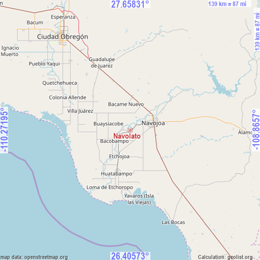
Navolato GPS coordinates[2]
27° 2' 1.572" North, 109° 34' 7.752" West
| Map corner | latitude | longitude |
|---|---|---|
| Upper-left | 27.65831°, | -110.27195° |
| Center: | 27.03377°, | -109.56882° |
| Lower-right: | 26.40573°, | -108.8657° |
| Map W x H: | 139.3×139.3 km | = 86.6×86.6mi |
| max Lat: | 32.7° ⇑3.6% North |
| Navolato: | 27.03377° |
| min Lat: | ⇓96.4% South 14.53588° |
| min Long | Navolato | max Long |
| -117.105° | -109.56882° | -86.73105° |
| W 2.4%⇐ | ⇒97.6% E |
Elevation
Elevation of Navolato is 28 m = 92 ft, and this is 1225.7 m = 4021 ft below average elevation for this country.
| Max E: |
3497 m = 11473 ft | 88.6% |
| Avg. | 1253.7 m = 4113 ft | |
| Navolato | 28 m = 92 ft | |
Min E: |
-1 m = -3 ft | 11.4% |
See also: Mexico elevation on elevation.city.
Geographical zone
Navolato is located in North temperate zone (between Tropic of Cancer and the Arctic Circle). Distance of this Northern Tropic circle is 400 km =248.5 mi to South.| Distance of | km | miles | from Navolato |
|---|---|---|---|
| North Pole | 7001.2 | 4350.3 | to North |
| Arctic Circle | 4395.3 | 2731.1 | to North |
| Tropic Cancer | 400 | 248.5 | to South |
| Equator | 3005.9 | 1867.8 | to South |


Nearby cities:
15 places around Navolato: (largest is in red/bold)
• Aquichopo
4.9 km =3 mi,  9°
9°
• Bacobampo
10.1 km =6.3 mi,  235°
235°
• Buaysiacobe
12.2 km =7.6 mi,  288°
288°
• Chinotahueca
3.9 km =2.4 mi,  105°
105°
• Chucarit
1.5 km =0.9 mi,  260°
260°
• El Recodo
6.3 km =3.9 mi,  40°
40°
• El Rodeo
7.6 km =4.7 mi,  253°
253°
• El Siviral (Jigica)
10.2 km =6.3 mi, 41°
• Guayparín
10.7 km =6.6 mi,  226°
226°
• Jitonhueca
4.7 km =2.9 mi,  310°
310°
• Las Playitas
7 km =4.3 mi,  219°
219°
• Rancho Camargo
8.3 km =5.2 mi,  27°
27°
• San Pedro Río Mayo
6.4 km =4 mi, 257°
• San Pedro Viejo
5.6 km =3.5 mi, 251°
• Siviral
10 km =6.2 mi, 41°
Sources, notices
• [Note1] Compared only with cities in Mexico existing in our database
• [Src1] Map data: © OpenStreetMap contributors (CC-BY-SA)
• [Src2] Other city data from geonames.org with taken over terms of usage.
• [Src3] Geographical zone / Annual Mean Temperature by Robert A. Rohde @ Wikipedia
