Desemboque geodata
Desemboque (Sonora) is a populated place; located in Mexico in America/Hermosillo (GMT-7) time zone. With population of 733 people, there are 11918 cities with bigger population in this country. Compared to other cities in Mexico, 98.7% of cities are located further ↓South; 99% of cities are located further →East and 98.1% of cities have higher elevation than Desemboque. Note1


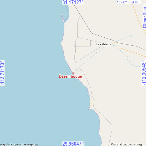
Desemboque GPS coordinates[2]
30° 34' 3.936" North, 113° 0' 30.96" West
| Map corner | latitude | longitude |
|---|---|---|
| Upper-left | 31.17127°, | -113.71173° |
| Center: | 30.56776°, | -113.0086° |
| Lower-right: | 29.96047°, | -112.30548° |
| Map W x H: | 134.6×134.6 km | = 83.6×83.6mi |
| max Lat: | 32.7° ⇑1.3% North |
| Desemboque: | 30.56776° |
| min Lat: | ⇓98.7% South 14.53588° |
| min Long | Desemboque | max Long |
| -117.105° | -113.0086° | -86.73105° |
| W 1%⇐ | ⇒99% E |
Elevation
Elevation of Desemboque is 8 m = 26 ft, and this is 1245.7 m = 4087 ft below average elevation for this country.
| Max E: |
3497 m = 11473 ft | 98.1% |
| Avg. | 1253.7 m = 4113 ft | |
| Desemboque | 8 m = 26 ft | |
Min E: |
-1 m = -3 ft | 1.9% |
See also: Mexico elevation on elevation.city.
Geographical zone
Desemboque is located in North temperate zone (between Tropic of Cancer and the Arctic Circle). Distance of this Northern Tropic circle is 792.9 km =492.7 mi to South.| Distance of | km | miles | from Desemboque |
|---|---|---|---|
| North Pole | 6608.2 | 4106.1 | to North |
| Arctic Circle | 4002.4 | 2487 | to North |
| Tropic Cancer | 792.9 | 492.7 | to South |
| Equator | 3398.8 | 2111.9 | to South |


Nearby cities:
15 places around Desemboque: (largest is in red/bold)
• Adolfo Oribe de Alva
40.9 km =25.4 mi,  0°
0°
• El Coyote
47.5 km =29.5 mi,  52°
52°
• El Diamante (La Retranca)
46.9 km =29.1 mi, 48°
• Heroica Caborca
83.1 km =51.6 mi,  78°
78°
• La Alameda (Cortázar)
27.6 km =17.1 mi, 49°
• La Almita
57.2 km =35.5 mi,  74°
74°
• La Libertad
78.9 km =49 mi,  157°
157°
• Pitiquito
92.1 km =57.2 mi, 82°
• Plutarco Elías Calles (La Y Griega)
38.1 km =23.7 mi, 46°
• Poblado San Felipe
35 km =21.7 mi,  30°
30°
• Puerto Peñasco
97.4 km =60.5 mi,  328°
328°
• Siempre Viva
56.7 km =35.2 mi, 69°
• Viñedo Viva (Pozo 5)
67.3 km =41.8 mi, 77°
• Álvaro Obregón
24.9 km =15.5 mi, 3°
• Último Esfuerzo
29.2 km =18.1 mi, 32°
Sources, notices
• [Note1] Compared only with cities in Mexico existing in our database
• [Src1] Map data: © OpenStreetMap contributors (CC-BY-SA)
• [Src2] Other city data from geonames.org with taken over terms of usage.
• [Src3] Geographical zone / Annual Mean Temperature by Robert A. Rohde @ Wikipedia
