Adolfo Oribe de Alva geodata
Adolfo Oribe de Alva (Sonora) is a populated place; located in Mexico in America/Hermosillo (GMT-7) time zone. With population of 659 people, there are 13168 cities with bigger population in this country. Compared to other cities in Mexico, 98.9% of cities are located further ↓South; 98.9% of cities are located further →East and 91.6% of cities have higher elevation than Adolfo Oribe de Alva. Note1


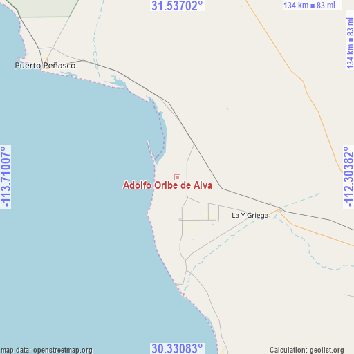
Adolfo Oribe de Alva GPS coordinates[2]
30° 56' 8.988" North, 113° 0' 24.984" West
| Map corner | latitude | longitude |
|---|---|---|
| Upper-left | 31.53702°, | -113.71007° |
| Center: | 30.93583°, | -113.00694° |
| Lower-right: | 30.33083°, | -112.30382° |
| Map W x H: | 134.1×134.1 km | = 83.3×83.3mi |
| max Lat: | 32.7° ⇑1.1% North |
| Adolfo Oribe de Alva: | 30.93583° |
| min Lat: | ⇓98.9% South 14.53588° |
| min Long | Adolfo Oribe de | max Long |
| -117.105° | -113.00694° | -86.73105° |
| W 1.1%⇐ | ⇒98.9% E |
Elevation
Elevation of Adolfo Oribe de Alva is 20 m = 66 ft, and this is 1233.7 m = 4048 ft below average elevation for this country.
| Max E: |
3497 m = 11473 ft | 91.6% |
| Avg. | 1253.7 m = 4113 ft | |
| Adolfo Oribe de Alva | 20 m = 66 ft | |
Min E: |
-1 m = -3 ft | 8.4% |
See also: Mexico elevation on elevation.city.
Geographical zone
Adolfo Oribe de Alva is located in North temperate zone (between Tropic of Cancer and the Arctic Circle). Distance of this Northern Tropic circle is 833.8 km =518.1 mi to South.| Distance of | km | miles | from Adolfo Oribe de Alva |
|---|---|---|---|
| North Pole | 6567.3 | 4080.7 | to North |
| Arctic Circle | 3961.4 | 2461.5 | to North |
| Tropic Cancer | 833.8 | 518.1 | to South |
| Equator | 3439.7 | 2137.3 | to South |


Nearby cities:
15 places around Adolfo Oribe de Alva: (largest is in red/bold)
• Desemboque
40.9 km =25.4 mi,  180°
180°
• El Coyote
39.2 km =24.4 mi,  107°
107°
• El Diamante (La Retranca)
36.4 km =22.6 mi, 105°
• Heroica Caborca
84.6 km =52.6 mi, 106°
• La Alameda (Cortázar)
31.2 km =19.4 mi,  137°
137°
• La Almita
60.4 km =37.5 mi, 114°
• Pitiquito
95.4 km =59.3 mi, 107°
• Plutarco Elías Calles (La Y Griega)
31.3 km =19.4 mi,  118°
118°
• Poblado San Felipe
20.9 km =13 mi, 121°
• Puerto Peñasco
66 km =41 mi,  309°
309°
• Siempre Viva
56.9 km =35.4 mi, 111°
• Sonoita
104 km =64.6 mi,  8°
8°
• Viñedo Viva (Pozo 5)
70.6 km =43.9 mi, 112°
• Álvaro Obregón
16.1 km =10 mi, 175°
• Último Esfuerzo
22.5 km =14 mi, 136°
Sources, notices
• [Note1] Compared only with cities in Mexico existing in our database
• [Src1] Map data: © OpenStreetMap contributors (CC-BY-SA)
• [Src2] Other city data from geonames.org with taken over terms of usage.
• [Src3] Geographical zone / Annual Mean Temperature by Robert A. Rohde @ Wikipedia
