Siempre Viva geodata
Siempre Viva (Sonora) is a populated place; located in Mexico in America/Hermosillo (GMT-7) time zone. With population of 815 people, there are 10718 cities with bigger population in this country. Compared to other cities in Mexico, 98.8% of cities are located further ↓South; 98.9% of cities are located further →East and 76.1% of cities have higher elevation than Siempre Viva. Note1


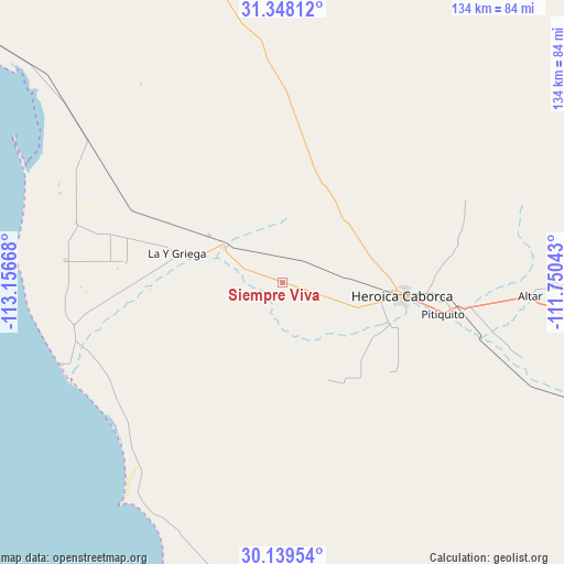
Siempre Viva GPS coordinates[2]
30° 44' 44.628" North, 112° 27' 12.78" West
| Map corner | latitude | longitude |
|---|---|---|
| Upper-left | 31.34812°, | -113.15668° |
| Center: | 30.74573°, | -112.45355° |
| Lower-right: | 30.13954°, | -111.75043° |
| Map W x H: | 134.4×134.4 km | = 83.5×83.5mi |
| max Lat: | 32.7° ⇑1.2% North |
| Siempre Viva: | 30.74573° |
| min Lat: | ⇓98.8% South 14.53588° |
| min Long | Siempre Viva | max Long |
| -117.105° | -112.45355° | -86.73105° |
| W 1.1%⇐ | ⇒98.9% E |
Elevation
Elevation of Siempre Viva is 183 m = 600 ft, and this is 1070.7 m = 3513 ft below average elevation for this country.
| Max E: |
3497 m = 11473 ft | 76.1% |
| Avg. | 1253.7 m = 4113 ft | |
| Siempre Viva | 183 m = 600 ft | |
Min E: |
-1 m = -3 ft | 23.9% |
See also: Mexico elevation on elevation.city.
Geographical zone
Siempre Viva is located in North temperate zone (between Tropic of Cancer and the Arctic Circle). Distance of this Northern Tropic circle is 812.7 km =505 mi to South.| Distance of | km | miles | from Siempre Viva |
|---|---|---|---|
| North Pole | 6588.5 | 4093.9 | to North |
| Arctic Circle | 3982.6 | 2474.7 | to North |
| Tropic Cancer | 812.7 | 505 | to South |
| Equator | 3418.6 | 2124.2 | to South |


Nearby cities:
15 places around Siempre Viva: (largest is in red/bold)
• Adolfo Oribe de Alva
56.9 km =35.4 mi,  291°
291°
• Altar
59 km =36.7 mi,  93°
93°
• Desemboque
56.7 km =35.2 mi,  249°
249°
• El Coyote
18 km =11.2 mi,  300°
300°
• El Diamante (La Retranca)
21 km =13 mi, 301°
• Heroica Caborca
28.4 km =17.6 mi,  96°
96°
• La Alameda (Cortázar)
32 km =19.9 mi,  266°
266°
• La Almita
4.7 km =2.9 mi,  155°
155°
• Oquitoa
68.7 km =42.7 mi, 90°
• Pitiquito
38.9 km =24.2 mi, 101°
• Plutarco Elías Calles (La Y Griega)
26.1 km =16.2 mi,  283°
283°
• Poblado San Felipe
36.5 km =22.7 mi, 286°
• Viñedo Viva (Pozo 5)
13.7 km =8.5 mi,  112°
112°
• Álvaro Obregón
51.9 km =32.2 mi, 275°
• Último Esfuerzo
37.7 km =23.4 mi, 277°
Sources, notices
• [Note1] Compared only with cities in Mexico existing in our database
• [Src1] Map data: © OpenStreetMap contributors (CC-BY-SA)
• [Src2] Other city data from geonames.org with taken over terms of usage.
• [Src3] Geographical zone / Annual Mean Temperature by Robert A. Rohde @ Wikipedia
