La Arquería geodata
La Arquería (Zacatecas) is a populated place; located in Mexico in America/Mexico_City (GMT-6) time zone. With population of 989 people, there are 8805 cities with bigger population in this country. Compared to other cities in Mexico, 85.7% of cities are located further ↓South; 79.8% of cities are located further →East and 80.1% of cities have lower elevation than La Arquería. Note1


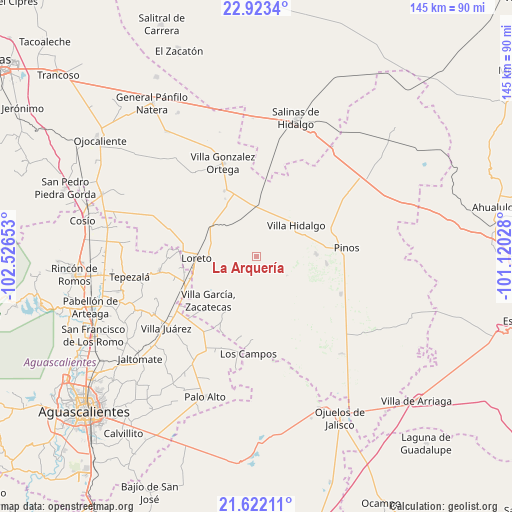
La Arquería GPS coordinates[2]
22° 16' 27.372" North, 101° 49' 24.24" West
| Map corner | latitude | longitude |
|---|---|---|
| Upper-left | 22.9234°, | -102.52653° |
| Center: | 22.27427°, | -101.8234° |
| Lower-right: | 21.62211°, | -101.12028° |
| Map W x H: | 144.7×144.7 km | = 89.9×89.9mi |
| max Lat: | 32.7° ⇑14.3% North |
| La Arquería: | 22.27427° |
| min Lat: | ⇓85.7% South 14.53588° |
| min Long | La Arquería | max Long |
| -117.105° | -101.8234° | -86.73105° |
| W 20.2%⇐ | ⇒79.8% E |
Elevation
Elevation of La Arquería is 2142 m = 7028 ft, and this is 888.3 m = 2914 ft above average elevation for this country.
| Max E: |
3497 m = 11473 ft | 19.9% |
| La Arquería | 2142 m 7028 ft | |
| Avg. | 1253.7 m = 4113 ft | |
Min E: |
-1 m = -3 ft | 80.1% |
See also: Mexico elevation on elevation.city.
Geographical zone
La Arquería is located in North Torrid zone (between Equator and Tropic of Cancer). Distance of this Northern Tropic circle is 129.3 km =80.3 mi to North.| Distance of | km | miles | from La Arquería |
|---|---|---|---|
| North Pole | 7530.4 | 4679.2 | to North |
| Arctic Circle | 4924.5 | 3059.9 | to North |
| Tropic Cancer | 129.3 | 80.3 | to North |
| Equator | 2476.7 | 1538.9 | to South |


Nearby cities:
15 places around La Arquería: (largest is in red/bold)
• Colonia José María Morelos
10.8 km =6.7 mi,  15°
15°
• Colonia San Francisco (San Francisco)
3.3 km =2.1 mi,  5°
5°
• El Fraile
9.1 km =5.7 mi,  74°
74°
• El Refugio
12.5 km =7.8 mi,  31°
31°
• El Tepozán
8.2 km =5.1 mi,  324°
324°
• Emilio Carranza
10.3 km =6.4 mi,  187°
187°
• Ignacio Zaragoza
7.1 km =4.4 mi,  358°
358°
• La Concepción
5.3 km =3.3 mi,  216°
216°
• La Lobeña
12.7 km =7.9 mi,  81°
81°
• La Pachona
10.1 km =6.3 mi,  120°
120°
• La Puerta de Jalisco
12.8 km =8 mi,  162°
162°
• Pedregoso
7.2 km =4.5 mi,  109°
109°
• Providencia
9.3 km =5.8 mi, 355°
• Rancho Nuevo de Morelos (De Guadalupe)
8.3 km =5.2 mi, 28°
• Santa María de los Ángeles
4.4 km =2.7 mi,  283°
283°
Sources, notices
• [Note1] Compared only with cities in Mexico existing in our database
• [Src1] Map data: © OpenStreetMap contributors (CC-BY-SA)
• [Src2] Other city data from geonames.org with taken over terms of usage.
• [Src3] Geographical zone / Annual Mean Temperature by Robert A. Rohde @ Wikipedia
