Pedregoso geodata
Pedregoso (Zacatecas) is a populated place; located in Mexico in America/Mexico_City (GMT-6) time zone. With population of 2,629 people, there are 3365 cities with bigger population in this country. Compared to other cities in Mexico, 85.5% of cities are located further ↓South; 79.4% of cities are located further →East and 81.8% of cities have lower elevation than Pedregoso. Note1


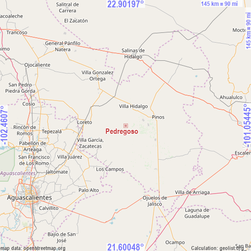
Pedregoso GPS coordinates[2]
22° 15' 9.864" North, 101° 45' 27.252" West
| Map corner | latitude | longitude |
|---|---|---|
| Upper-left | 22.90197°, | -102.4607° |
| Center: | 22.25274°, | -101.75757° |
| Lower-right: | 21.60048°, | -101.05445° |
| Map W x H: | 144.7×144.7 km | = 89.9×89.9mi |
| max Lat: | 32.7° ⇑14.5% North |
| Pedregoso: | 22.25274° |
| min Lat: | ⇓85.5% South 14.53588° |
| min Long | Pedregoso | max Long |
| -117.105° | -101.75757° | -86.73105° |
| W 20.6%⇐ | ⇒79.4% E |
Elevation
Elevation of Pedregoso is 2185 m = 7169 ft, and this is 931.3 m = 3055 ft above average elevation for this country.
| Max E: |
3497 m = 11473 ft | 18.2% |
| Pedregoso | 2185 m 7169 ft | |
| Avg. | 1253.7 m = 4113 ft | |
Min E: |
-1 m = -3 ft | 81.8% |
See also: Mexico elevation on elevation.city.
Geographical zone
Pedregoso is located in North Torrid zone (between Equator and Tropic of Cancer). Distance of this Northern Tropic circle is 131.6 km =81.8 mi to North.| Distance of | km | miles | from Pedregoso |
|---|---|---|---|
| North Pole | 7532.8 | 4680.7 | to North |
| Arctic Circle | 4926.9 | 3061.4 | to North |
| Tropic Cancer | 131.6 | 81.8 | to North |
| Equator | 2474.3 | 1537.5 | to South |


Nearby cities:
15 places around Pedregoso: (largest is in red/bold)
• Colonia San Francisco (San Francisco)
8.6 km =5.3 mi,  311°
311°
• El Chino
12.6 km =7.8 mi,  53°
53°
• El Fraile
5.3 km =3.3 mi,  22°
22°
• El Nigromante
12 km =7.5 mi,  156°
156°
• Emilio Carranza
11.2 km =7 mi,  225°
225°
• Estancia de Guadalupe
10.8 km =6.7 mi,  73°
73°
• Ignacio Zaragoza
11.7 km =7.3 mi,  323°
323°
• La Arquería
7.2 km =4.5 mi,  289°
289°
• La Concepción
10.1 km =6.3 mi,  259°
259°
• La Lobeña
7.3 km =4.5 mi, 53°
• La Pachona
3.4 km =2.1 mi,  145°
145°
• La Puerta de Jalisco
10.3 km =6.4 mi,  196°
196°
• Rancho Nuevo de Morelos (De Guadalupe)
10.2 km =6.3 mi,  343°
343°
• Santa María de los Ángeles
11.6 km =7.2 mi, 287°
• Villa Hidalgo
12.5 km =7.8 mi, 21°
Sources, notices
• [Note1] Compared only with cities in Mexico existing in our database
• [Src1] Map data: © OpenStreetMap contributors (CC-BY-SA)
• [Src2] Other city data from geonames.org with taken over terms of usage.
• [Src3] Geographical zone / Annual Mean Temperature by Robert A. Rohde @ Wikipedia
