Providencia geodata
Providencia (Zacatecas) is a populated place; located in Mexico in America/Mexico_City (GMT-6) time zone. With population of 720 people, there are 12117 cities with bigger population in this country. Compared to other cities in Mexico, 86% of cities are located further ↓South; 79.9% of cities are located further →East and 81% of cities have lower elevation than Providencia. Note1


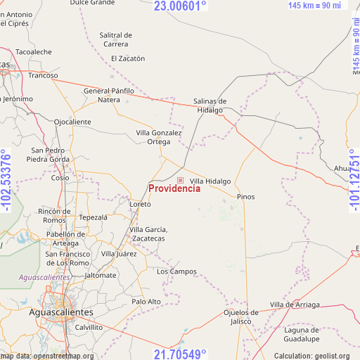
Providencia GPS coordinates[2]
22° 21' 26.172" North, 101° 49' 50.268" West
| Map corner | latitude | longitude |
|---|---|---|
| Upper-left | 23.00601°, | -102.53376° |
| Center: | 22.35727°, | -101.83063° |
| Lower-right: | 21.70549°, | -101.12751° |
| Map W x H: | 144.6×144.6 km | = 89.9×89.9mi |
| max Lat: | 32.7° ⇑14% North |
| Providencia: | 22.35727° |
| min Lat: | ⇓86% South 14.53588° |
| min Long | Providencia | max Long |
| -117.105° | -101.83063° | -86.73105° |
| W 20.1%⇐ | ⇒79.9% E |
Elevation
Elevation of Providencia is 2163 m = 7096 ft, and this is 909.3 m = 2983 ft above average elevation for this country.
| Max E: |
3497 m = 11473 ft | 19% |
| Providencia | 2163 m 7096 ft | |
| Avg. | 1253.7 m = 4113 ft | |
Min E: |
-1 m = -3 ft | 81% |
See also: Mexico elevation on elevation.city.
Geographical zone
Providencia is located in North Torrid zone (between Equator and Tropic of Cancer). Distance of this Northern Tropic circle is 120 km =74.6 mi to North.| Distance of | km | miles | from Providencia |
|---|---|---|---|
| North Pole | 7521.2 | 4673.5 | to North |
| Arctic Circle | 4915.3 | 3054.2 | to North |
| Tropic Cancer | 120 | 74.6 | to North |
| Equator | 2485.9 | 1544.7 | to South |


Nearby cities:
15 places around Providencia: (largest is in red/bold)
• Canoas
8 km =5 mi,  68°
68°
• Colonia José María Morelos
3.9 km =2.4 mi, 72°
• Colonia San Francisco (San Francisco)
6.1 km =3.8 mi,  170°
170°
• El Fraile
11.7 km =7.3 mi,  125°
125°
• El Refugio
7.3 km =4.5 mi,  78°
78°
• El Salitre
7.3 km =4.5 mi,  45°
45°
• El Tepetate
13.7 km =8.5 mi, 73°
• El Tepozán
4.7 km =2.9 mi,  237°
237°
• Ignacio Zaragoza
2.2 km =1.4 mi,  164°
164°
• La Arquería
9.3 km =5.8 mi,  175°
175°
• La Lagunita
12 km =7.5 mi,  21°
21°
• Noria de Ángeles
12.5 km =7.8 mi,  320°
320°
• Rancho Nuevo de Morelos (De Guadalupe)
5 km =3.1 mi,  111°
111°
• Santa María de los Ángeles
8.9 km =5.5 mi,  203°
203°
• Villa Hidalgo
12.1 km =7.5 mi,  90°
90°
Sources, notices
• [Note1] Compared only with cities in Mexico existing in our database
• [Src1] Map data: © OpenStreetMap contributors (CC-BY-SA)
• [Src2] Other city data from geonames.org with taken over terms of usage.
• [Src3] Geographical zone / Annual Mean Temperature by Robert A. Rohde @ Wikipedia
