San Blas geodata
San Blas (Zacatecas) is a populated place; located in Mexico in America/Mexico_City (GMT-6) time zone. With population of 1,068 people, there are 8166 cities with bigger population in this country. Compared to other cities in Mexico, 85.8% of cities are located further ↓South; 80.7% of cities are located further →East and 76.8% of cities have lower elevation than San Blas. Note1


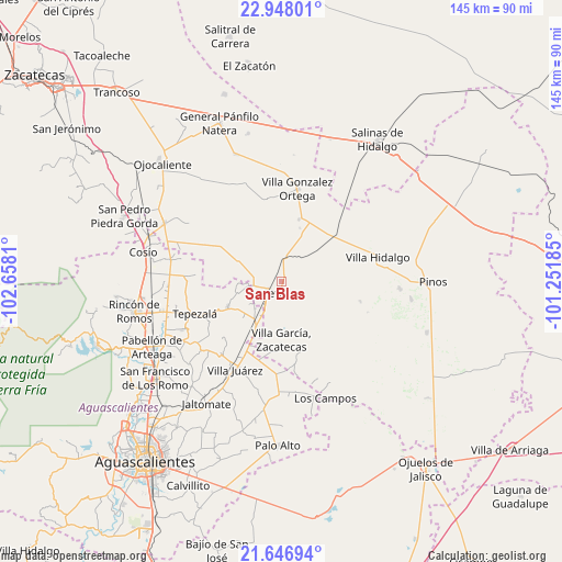
San Blas GPS coordinates[2]
22° 17' 56.364" North, 101° 57' 17.892" West
| Map corner | latitude | longitude |
|---|---|---|
| Upper-left | 22.94801°, | -102.6581° |
| Center: | 22.29899°, | -101.95497° |
| Lower-right: | 21.64694°, | -101.25185° |
| Map W x H: | 144.7×144.7 km | = 89.9×89.9mi |
| max Lat: | 32.7° ⇑14.2% North |
| San Blas: | 22.29899° |
| min Lat: | ⇓85.8% South 14.53588° |
| min Long | San Blas | max Long |
| -117.105° | -101.95497° | -86.73105° |
| W 19.3%⇐ | ⇒80.7% E |
Elevation
Elevation of San Blas is 2063 m = 6768 ft, and this is 809.3 m = 2655 ft above average elevation for this country.
| Max E: |
3497 m = 11473 ft | 23.2% |
| San Blas | 2063 m 6768 ft | |
| Avg. | 1253.7 m = 4113 ft | |
Min E: |
-1 m = -3 ft | 76.8% |
See also: Mexico elevation on elevation.city.
Geographical zone
San Blas is located in North Torrid zone (between Equator and Tropic of Cancer). Distance of this Northern Tropic circle is 126.5 km =78.6 mi to North.| Distance of | km | miles | from San Blas |
|---|---|---|---|
| North Pole | 7527.6 | 4677.4 | to North |
| Arctic Circle | 4921.8 | 3058.3 | to North |
| Tropic Cancer | 126.5 | 78.6 | to North |
| Equator | 2479.4 | 1540.6 | to South |


Nearby cities:
15 places around San Blas: (largest is in red/bold)
• Bimbaletes
7.5 km =4.7 mi,  221°
221°
• Bimbaletes Aguascalientes (El Álamo)
9.8 km =6.1 mi, 222°
• Bimbaletes Atlas
10.1 km =6.3 mi,  234°
234°
• Colonia Hidalgo (El Tecolote)
9 km =5.6 mi,  292°
292°
• Crisóstomos
8.8 km =5.5 mi,  208°
208°
• Ejido Hidalgo
8.6 km =5.3 mi,  271°
271°
• El Prieto
7.1 km =4.4 mi, 269°
• El Tepozán
9.6 km =6 mi,  66°
66°
• Guadalupe de Atlas
8.6 km =5.3 mi,  245°
245°
• La Loma (El Bajío)
6.2 km =3.9 mi, 210°
• Loreto
4.6 km =2.9 mi, 229°
• Noria del Borrego (Norias)
9 km =5.6 mi,  261°
261°
• Norias de Guadalupe
6.7 km =4.2 mi,  241°
241°
• San Marcos
2.4 km =1.5 mi,  172°
172°
• Santa María de los Ángeles
9.4 km =5.8 mi,  100°
100°
Sources, notices
• [Note1] Compared only with cities in Mexico existing in our database
• [Src1] Map data: © OpenStreetMap contributors (CC-BY-SA)
• [Src2] Other city data from geonames.org with taken over terms of usage.
• [Src3] Geographical zone / Annual Mean Temperature by Robert A. Rohde @ Wikipedia
