El Salitre geodata
El Salitre (Zacatecas) is a populated place; located in Mexico in America/Mexico_City (GMT-6) time zone. With population of 772 people, there are 11323 cities with bigger population in this country. Compared to other cities in Mexico, 86.3% of cities are located further ↓South; 79.6% of cities are located further →East and 79% of cities have lower elevation than El Salitre. Note1


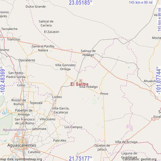
El Salitre GPS coordinates[2]
22° 24' 11.988" North, 101° 46' 50.016" West
| Map corner | latitude | longitude |
|---|---|---|
| Upper-left | 23.05185°, | -102.48369° |
| Center: | 22.40333°, | -101.78056° |
| Lower-right: | 21.75177°, | -101.07744° |
| Map W x H: | 144.6×144.6 km | = 89.9×89.9mi |
| max Lat: | 32.7° ⇑13.7% North |
| El Salitre: | 22.40333° |
| min Lat: | ⇓86.3% South 14.53588° |
| min Long | El Salitre | max Long |
| -117.105° | -101.78056° | -86.73105° |
| W 20.4%⇐ | ⇒79.6% E |
Elevation
Elevation of El Salitre is 2113 m = 6932 ft, and this is 859.3 m = 2819 ft above average elevation for this country.
| Max E: |
3497 m = 11473 ft | 21% |
| El Salitre | 2113 m 6932 ft | |
| Avg. | 1253.7 m = 4113 ft | |
Min E: |
-1 m = -3 ft | 79% |
See also: Mexico elevation on elevation.city.
Geographical zone
El Salitre is located in North Torrid zone (between Equator and Tropic of Cancer). Distance of this Northern Tropic circle is 114.9 km =71.4 mi to North.| Distance of | km | miles | from El Salitre |
|---|---|---|---|
| North Pole | 7516 | 4670.2 | to North |
| Arctic Circle | 4910.2 | 3051.1 | to North |
| Tropic Cancer | 114.9 | 71.4 | to North |
| Equator | 2491 | 1547.8 | to South |


Nearby cities:
15 places around El Salitre: (largest is in red/bold)
• Caballerías (Caballería Villa Hidalgo)
13.3 km =8.3 mi,  98°
98°
• Canoas
3.1 km =1.9 mi,  133°
133°
• Colonia José María Morelos
4.2 km =2.6 mi,  199°
199°
• Colonia San Francisco (San Francisco)
11.8 km =7.3 mi, 200°
• El Fraile
12.7 km =7.9 mi,  159°
159°
• El Refugio
4.2 km =2.6 mi,  151°
151°
• El Tepetate
8 km =5 mi, 98°
• El Tepozán
11.9 km =7.4 mi,  229°
229°
• Ignacio Zaragoza
8.6 km =5.3 mi,  212°
212°
• La Ballena
9.5 km =5.9 mi,  51°
51°
• La Lagunita
6 km =3.7 mi,  353°
353°
• Presa de Valenzuela
12.7 km =7.9 mi,  118°
118°
• Providencia
7.3 km =4.5 mi, 225°
• Rancho Nuevo de Morelos (De Guadalupe)
7 km =4.3 mi,  183°
183°
• Villa Hidalgo
8.7 km =5.4 mi, 126°
Sources, notices
• [Note1] Compared only with cities in Mexico existing in our database
• [Src1] Map data: © OpenStreetMap contributors (CC-BY-SA)
• [Src2] Other city data from geonames.org with taken over terms of usage.
• [Src3] Geographical zone / Annual Mean Temperature by Robert A. Rohde @ Wikipedia
