San Rafael de las Tablas geodata
San Rafael de las Tablas (Zacatecas) is a populated place; located in Mexico in America/Mexico_City (GMT-6) time zone. With population of 553 people, there are 15422 cities with bigger population in this country. Compared to other cities in Mexico, 87.5% of cities are located further ↓South; 90.3% of cities are located further →East and 57.1% of cities have higher elevation than San Rafael de las Tablas. Note1
Current local time in San Rafael de las Tablas:
01:42 PM, MondayDifference from your time zone: hours


San Rafael de las Tablas GPS coordinates[2]
22° 47' 39.516" North, 104° 5' 46.392" West
| Map corner | latitude | longitude |
|---|---|---|
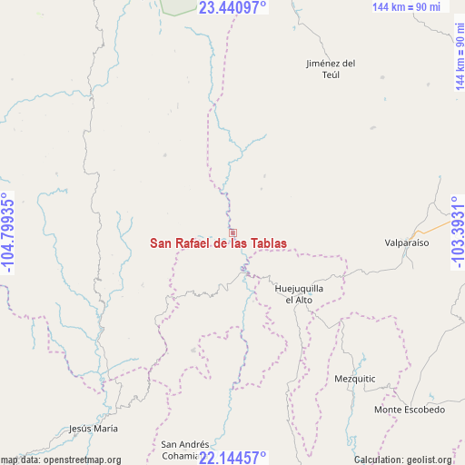
| Upper-left | 23.44097°, | -104.79935° |
| Center: | 22.79431°, | -104.09622° |
| Lower-right: | 22.14457°, | -103.3931° |
| Map W x H: | 144.1×144.1 km | = 89.5×89.5mi |
| max Lat: | 32.7° ⇑12.5% North |
| San Rafael de las Tablas: | 22.79431° |
| min Lat: | ⇓87.5% South 14.53588° |
| min Long | San Rafael de l | max Long |
| -117.105° | -104.09622° | -86.73105° |
| W 9.7%⇐ | ⇒90.3% E |
Elevation
Elevation of San Rafael de las Tablas is 1120 m = 3675 ft, and this is 133.7 m = 439 ft below average elevation for this country.
| Max E: |
3497 m = 11473 ft | 57.1% |
| Avg. | 1253.7 m = 4113 ft | |
| San Rafael de las Tablas | 1120 m = 3675 ft | |
Min E: |
-1 m = -3 ft | 42.9% |
See also: Mexico elevation on elevation.city.
Geographical zone
San Rafael de las Tablas is located in North Torrid zone (between Equator and Tropic of Cancer). Distance of this Northern Tropic circle is 71.4 km =44.4 mi to North.| Distance of | km | miles | from San Rafael de las Tablas |
|---|---|---|---|
| North Pole | 7472.6 | 4643.3 | to North |
| Arctic Circle | 4866.7 | 3024 | to North |
| Tropic Cancer | 71.4 | 44.4 | to North |
| Equator | 2534.5 | 1574.9 | to South |


Nearby cities:
15 places around San Rafael de las Tablas: (largest is in red/bold)
• Bancos de Calitique
49.4 km =30.7 mi,  218°
218°
• Huazamota
50.8 km =31.6 mi,  233°
233°
• Huejuquilla el Alto
27.7 km =17.2 mi,  132°
132°
• J. Jesús González Ortega (San Mateo)
63.5 km =39.5 mi,  80°
80°
• Jiménez del Teul
59.5 km =37 mi,  30°
30°
• Llano Grande
44.6 km =27.7 mi,  280°
280°
• Mezquitic
58.9 km =36.6 mi,  139°
139°
• Milpillas de la Sierra
53.8 km =33.4 mi,  52°
52°
• San Antonio de Padua
35.2 km =21.9 mi, 134°
• San Juan Capistrano
16.8 km =10.4 mi,  181°
181°
• Santa Lucía de la Sierra
38.1 km =23.7 mi,  199°
199°
• Santa María de Ocotán
53.3 km =33.1 mi, 284°
• Tenzompa
50.1 km =31.1 mi,  159°
159°
• Trojes
57.5 km =35.7 mi,  86°
86°
• Valparaíso
54 km =33.6 mi, 92°
Sources, notices
• [Note1] Compared only with cities in Mexico existing in our database
• [Src1] Map data: © OpenStreetMap contributors (CC-BY-SA)
• [Src2] Other city data from geonames.org with taken over terms of usage.
• [Src3] Geographical zone / Annual Mean Temperature by Robert A. Rohde @ Wikipedia
