Llano Grande geodata
Llano Grande (Durango) is a populated place; located in Mexico in America/Monterrey (GMT-6) time zone. With population of 676 people, there are 12846 cities with bigger population in this country. Compared to other cities in Mexico, 87.7% of cities are located further ↓South; 91% of cities are located further →East and 86.4% of cities have lower elevation than Llano Grande. Note1


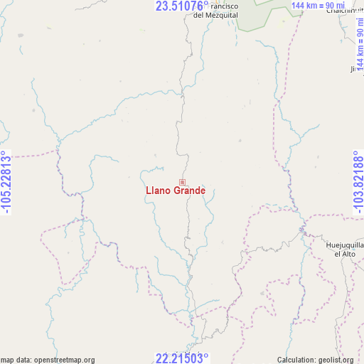
Llano Grande GPS coordinates[2]
22° 51' 51.984" North, 104° 31' 30" West
| Map corner | latitude | longitude |
|---|---|---|
| Upper-left | 23.51076°, | -105.22813° |
| Center: | 22.86444°, | -104.525° |
| Lower-right: | 22.21503°, | -103.82188° |
| Map W x H: | 144.1×144.1 km | = 89.5×89.5mi |
| max Lat: | 32.7° ⇑12.3% North |
| Llano Grande: | 22.86444° |
| min Lat: | ⇓87.7% South 14.53588° |
| min Long | Llano Grande | max Long |
| -117.105° | -104.525° | -86.73105° |
| W 9%⇐ | ⇒91% E |
Elevation
Elevation of Llano Grande is 2292 m = 7520 ft, and this is 1038.3 m = 3406 ft above average elevation for this country.
| Max E: |
3497 m = 11473 ft | 13.6% |
| Llano Grande | 2292 m 7520 ft | |
| Avg. | 1253.7 m = 4113 ft | |
Min E: |
-1 m = -3 ft | 86.4% |
See also: Mexico elevation on elevation.city.
Geographical zone
Llano Grande is located in North Torrid zone (between Equator and Tropic of Cancer). Distance of this Northern Tropic circle is 63.6 km =39.5 mi to North.| Distance of | km | miles | from Llano Grande |
|---|---|---|---|
| North Pole | 7464.8 | 4638.4 | to North |
| Arctic Circle | 4858.9 | 3019.2 | to North |
| Tropic Cancer | 63.6 | 39.5 | to North |
| Equator | 2542.3 | 1579.7 | to South |


Nearby cities:
15 places around Llano Grande: (largest is in red/bold)
• Bancos de Calitique
48.5 km =30.1 mi,  163°
163°
• El Troncón
71.2 km =44.2 mi,  11°
11°
• Huazamota
37.9 km =23.5 mi,  175°
175°
• Huejuquilla el Alto
69.6 km =43.2 mi,  112°
112°
• Jesús María
68.3 km =42.4 mi, 179°
• Linda Vista
60.6 km =37.7 mi,  210°
210°
• San Andrés Milpillas
60.9 km =37.8 mi,  269°
269°
• San Francisco
64.1 km =39.8 mi, 177°
• San Francisco de Lajas
65.3 km =40.6 mi,  295°
295°
• San Francisco del Mezquital
69.1 km =42.9 mi, 11°
• San Juan Capistrano
49.9 km =31 mi,  119°
119°
• San Rafael de las Tablas
44.6 km =27.7 mi,  100°
100°
• Santa Lucía de la Sierra
54 km =33.6 mi,  144°
144°
• Santa María de Ocotán
9.6 km =6 mi,  307°
307°
• Santa Teresa
47.7 km =29.6 mi, 211°
Sources, notices
• [Note1] Compared only with cities in Mexico existing in our database
• [Src1] Map data: © OpenStreetMap contributors (CC-BY-SA)
• [Src2] Other city data from geonames.org with taken over terms of usage.
• [Src3] Geographical zone / Annual Mean Temperature by Robert A. Rohde @ Wikipedia
