La Norteña geodata
La Norteña (Chihuahua) is a populated place; located in Mexico in America/Chihuahua (GMT-6) time zone. With population of 822 people, there are 10631 cities with bigger population in this country. Compared to other cities in Mexico, 98.3% of cities are located further ↓South; 96.3% of cities are located further →East and 81.3% of cities have lower elevation than La Norteña. Note1


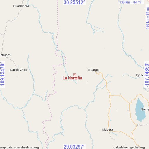
La Norteña GPS coordinates[2]
29° 38' 45.24" North, 108° 27' 5.94" West
| Map corner | latitude | longitude |
|---|---|---|
| Upper-left | 30.25512°, | -109.15478° |
| Center: | 29.6459°, | -108.45165° |
| Lower-right: | 29.03297°, | -107.74853° |
| Map W x H: | 135.9×135.9 km | = 84.4×84.4mi |
| max Lat: | 32.7° ⇑1.7% North |
| La Norteña: | 29.6459° |
| min Lat: | ⇓98.3% South 14.53588° |
| min Long | La Norteña | max Long |
| -117.105° | -108.45165° | -86.73105° |
| W 3.7%⇐ | ⇒96.3% E |
Elevation
Elevation of La Norteña is 2172 m = 7126 ft, and this is 918.3 m = 3013 ft above average elevation for this country.
| Max E: |
3497 m = 11473 ft | 18.7% |
| La Norteña | 2172 m 7126 ft | |
| Avg. | 1253.7 m = 4113 ft | |
Min E: |
-1 m = -3 ft | 81.3% |
See also: Mexico elevation on elevation.city.
Geographical zone
La Norteña is located in North temperate zone (between Tropic of Cancer and the Arctic Circle). Distance of this Northern Tropic circle is 690.4 km =429 mi to South.| Distance of | km | miles | from La Norteña |
|---|---|---|---|
| North Pole | 6710.7 | 4169.8 | to North |
| Arctic Circle | 4104.9 | 2550.7 | to North |
| Tropic Cancer | 690.4 | 429 | to South |
| Equator | 3296.3 | 2048.2 | to South |


Nearby cities:
15 places around La Norteña: (largest is in red/bold)
• Bacadéhuachi
68.9 km =42.8 mi,  285°
285°
• Benito Juárez
50.7 km =31.5 mi,  77°
77°
• Ejido El Largo
18.4 km =11.4 mi, 76°
• Francisco I. Madero
62.9 km =39.1 mi, 83°
• Gómez Farías
75.9 km =47.2 mi,  114°
114°
• Huachinera
79.5 km =49.4 mi,  322°
322°
• Ignacio Allende
70.7 km =43.9 mi,  94°
94°
• Ignacio Zaragoza
66.5 km =41.3 mi, 90°
• Las Varas (Estación Babícora)
45.1 km =28 mi, 114°
• Madera
58.3 km =36.2 mi,  149°
149°
• Mesa Tres Ríos
33.2 km =20.6 mi,  310°
310°
• Mesa del Huracán
19.5 km =12.1 mi, 81°
• Nicolas Bravo
59.7 km =37.1 mi,  123°
123°
• Nácori Chico
51.3 km =31.9 mi,  275°
275°
• San José Bavícora
81.2 km =50.5 mi, 122°
Sources, notices
• [Note1] Compared only with cities in Mexico existing in our database
• [Src1] Map data: © OpenStreetMap contributors (CC-BY-SA)
• [Src2] Other city data from geonames.org with taken over terms of usage.
• [Src3] Geographical zone / Annual Mean Temperature by Robert A. Rohde @ Wikipedia
