Mesa Tres Ríos geodata
Mesa Tres Ríos (Sonora) is a populated place; located in Mexico in America/Hermosillo (GMT-7) time zone. With population of 608 people, there are 14173 cities with bigger population in this country. Compared to other cities in Mexico, 98.4% of cities are located further ↓South; 96.6% of cities are located further →East and 68.6% of cities have lower elevation than Mesa Tres Ríos. Note1


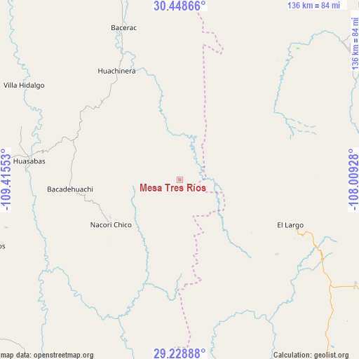
Mesa Tres Ríos GPS coordinates[2]
29° 50' 26.268" North, 108° 42' 44.64" West
| Map corner | latitude | longitude |
|---|---|---|
| Upper-left | 30.44866°, | -109.41553° |
| Center: | 29.84063°, | -108.7124° |
| Lower-right: | 29.22888°, | -108.00928° |
| Map W x H: | 135.6×135.6 km | = 84.3×84.3mi |
| max Lat: | 32.7° ⇑1.6% North |
| Mesa Tres Ríos: | 29.84063° |
| min Lat: | ⇓98.4% South 14.53588° |
| min Long | Mesa Tres Ríos | max Long |
| -117.105° | -108.7124° | -86.73105° |
| W 3.4%⇐ | ⇒96.6% E |
Elevation
Elevation of Mesa Tres Ríos is 1901 m = 6237 ft, and this is 647.3 m = 2124 ft above average elevation for this country.
| Max E: |
3497 m = 11473 ft | 31.4% |
| Mesa Tres Ríos | 1901 m 6237 ft | |
| Avg. | 1253.7 m = 4113 ft | |
Min E: |
-1 m = -3 ft | 68.6% |
See also: Mexico elevation on elevation.city.
Geographical zone
Mesa Tres Ríos is located in North temperate zone (between Tropic of Cancer and the Arctic Circle). Distance of this Northern Tropic circle is 712 km =442.4 mi to South.| Distance of | km | miles | from Mesa Tres Ríos |
|---|---|---|---|
| North Pole | 6689.1 | 4156.4 | to North |
| Arctic Circle | 4083.2 | 2537.2 | to North |
| Tropic Cancer | 712 | 442.4 | to South |
| Equator | 3318 | 2061.7 | to South |


Nearby cities:
15 places around Mesa Tres Ríos: (largest is in red/bold)
• Bacadéhuachi
41.5 km =25.8 mi,  265°
265°
• Bacerac
61 km =37.9 mi,  339°
339°
• Bavispe
74.3 km =46.2 mi, 342°
• Benito Juárez
75.3 km =46.8 mi,  98°
98°
• Divisaderos
77.3 km =48 mi,  251°
251°
• Ejido El Largo
46.4 km =28.8 mi,  112°
112°
• Granados
57.7 km =35.9 mi, 272°
• Huachinera
47.4 km =29.5 mi,  330°
330°
• Huásabas
57.2 km =35.5 mi,  277°
277°
• Juárez
80.3 km =49.9 mi,  49°
49°
• La Norteña
33.2 km =20.6 mi,  130°
130°
• Las Varas (Estación Babícora)
77.5 km =48.2 mi,  121°
121°
• Mesa del Huracán
48.3 km =30 mi, 113°
• Nácori Chico
31 km =19.3 mi,  236°
236°
• Villa Hidalgo
68.7 km =42.7 mi,  301°
301°
Sources, notices
• [Note1] Compared only with cities in Mexico existing in our database
• [Src1] Map data: © OpenStreetMap contributors (CC-BY-SA)
• [Src2] Other city data from geonames.org with taken over terms of usage.
• [Src3] Geographical zone / Annual Mean Temperature by Robert A. Rohde @ Wikipedia
