Barreales geodata
Barreales (Chihuahua) is a populated place; located in Mexico in America/Chihuahua (GMT-6) time zone. With population of 540 people, there are 15727 cities with bigger population in this country. Compared to other cities in Mexico, 99.1% of cities are located further ↓South; 93.8% of cities are located further →East and 58.2% of cities have higher elevation than Barreales. Note1


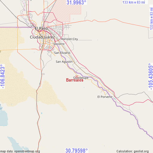
Barreales GPS coordinates[2]
31° 23' 53.016" North, 106° 8' 21.012" West
| Map corner | latitude | longitude |
|---|---|---|
| Upper-left | 31.9963°, | -106.8423° |
| Center: | 31.39806°, | -106.13917° |
| Lower-right: | 30.79598°, | -105.43605° |
| Map W x H: | 133.5×133.5 km | = 83×83mi |
| max Lat: | 32.7° ⇑0.9% North |
| Barreales: | 31.39806° |
| min Lat: | ⇓99.1% South 14.53588° |
| min Long | Barreales | max Long |
| -117.105° | -106.13917° | -86.73105° |
| W 6.2%⇐ | ⇒93.8% E |
Elevation
Elevation of Barreales is 1095 m = 3593 ft, and this is 158.7 m = 521 ft below average elevation for this country.
| Max E: |
3497 m = 11473 ft | 58.2% |
| Avg. | 1253.7 m = 4113 ft | |
| Barreales | 1095 m = 3593 ft | |
Min E: |
-1 m = -3 ft | 41.8% |
See also: Mexico elevation on elevation.city.
Geographical zone
Barreales is located in North temperate zone (between Tropic of Cancer and the Arctic Circle). Distance of this Northern Tropic circle is 885.2 km =550 mi to South.| Distance of | km | miles | from Barreales |
|---|---|---|---|
| North Pole | 6515.9 | 4048.8 | to North |
| Arctic Circle | 3910 | 2429.6 | to North |
| Tropic Cancer | 885.2 | 550 | to South |
| Equator | 3491.1 | 2169.3 | to South |


Nearby cities:
15 places around Barreales: (largest is in red/bold)
• Esperanza
18.4 km =11.4 mi,  114°
114°
• Guadalupe
3.3 km =2.1 mi, 106°
• Jesús Carranza (La Colorada)
13.9 km =8.6 mi,  318°
318°
• Juárez
47 km =29.2 mi, 319°
• Juárez y Reforma
5.5 km =3.4 mi,  327°
327°
• Loma Blanca
25.1 km =15.6 mi, 323°
• Miguel Ahumada
93.7 km =58.2 mi,  202°
202°
• Porvenir
30.5 km =19 mi,  125°
125°
• Praxedis G. Guerrero
13 km =8.1 mi,  103°
103°
• Praxédis Guerrero
12.1 km =7.5 mi, 106°
• Rinconada del Mimbre
10.4 km =6.5 mi,  123°
123°
• Samalayuca
32.9 km =20.4 mi,  259°
259°
• San Agustín
17.2 km =10.7 mi, 320°
• San Isidro
21.2 km =13.2 mi, 321°
• Tres Jacales
8.9 km =5.5 mi, 318°
Sources, notices
• [Note1] Compared only with cities in Mexico existing in our database
• [Src1] Map data: © OpenStreetMap contributors (CC-BY-SA)
• [Src2] Other city data from geonames.org with taken over terms of usage.
• [Src3] Geographical zone / Annual Mean Temperature by Robert A. Rohde @ Wikipedia
