Miguel Ahumada geodata
Miguel Ahumada (Chihuahua) is a populated place; located in Mexico in America/Chihuahua (GMT-6) time zone. With population of 8,575 people, there are 1113 cities with bigger population in this country. Compared to other cities in Mexico, 98.7% of cities are located further ↓South; 94.1% of cities are located further →East and 55% of cities have higher elevation than Miguel Ahumada. Note1


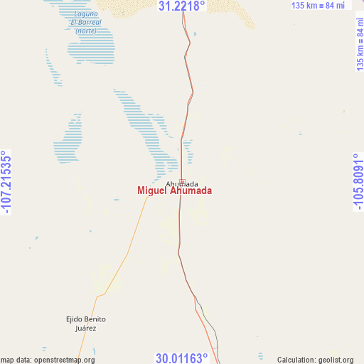
Miguel Ahumada GPS coordinates[2]
30° 37' 6.996" North, 106° 30' 43.992" West
| Map corner | latitude | longitude |
|---|---|---|
| Upper-left | 31.2218°, | -107.21535° |
| Center: | 30.61861°, | -106.51222° |
| Lower-right: | 30.01163°, | -105.8091° |
| Map W x H: | 134.6×134.6 km | = 83.6×83.6mi |
| max Lat: | 32.7° ⇑1.3% North |
| Miguel Ahumada: | 30.61861° |
| min Lat: | ⇓98.7% South 14.53588° |
| min Long | Miguel Ahumada | max Long |
| -117.105° | -106.51222° | -86.73105° |
| W 5.9%⇐ | ⇒94.1% E |
Elevation
Elevation of Miguel Ahumada is 1197 m = 3927 ft, and this is 56.7 m = 186 ft below average elevation for this country.
| Max E: |
3497 m = 11473 ft | 55% |
| Avg. | 1253.7 m = 4113 ft | |
| Miguel Ahumada | 1197 m = 3927 ft | |
Min E: |
-1 m = -3 ft | 45% |
See also: Mexico elevation on elevation.city.
Geographical zone
Miguel Ahumada is located in North temperate zone (between Tropic of Cancer and the Arctic Circle). Distance of this Northern Tropic circle is 798.6 km =496.2 mi to South.| Distance of | km | miles | from Miguel Ahumada |
|---|---|---|---|
| North Pole | 6602.6 | 4102.7 | to North |
| Arctic Circle | 3996.7 | 2483.4 | to North |
| Tropic Cancer | 798.6 | 496.2 | to South |
| Equator | 3404.5 | 2115.5 | to South |


Nearby cities:
15 places around Miguel Ahumada: (largest is in red/bold)
• Barreales
93.7 km =58.2 mi,  22°
22°
• Colonia el Valle
97.8 km =60.8 mi,  233°
233°
• Ejido Benito Juárez
63.2 km =39.3 mi,  214°
214°
• Esperanza
95 km =59 mi,  33°
33°
• Guadalupe
94.1 km =58.5 mi, 24°
• Jesús Carranza (La Colorada)
100.7 km =62.6 mi, 15°
• Juárez y Reforma
97 km =60.3 mi, 19°
• La Constitución
82.2 km =51.1 mi,  199°
199°
• Ojo Caliente
14.3 km =8.9 mi,  193°
193°
• Porvenir
91.9 km =57.1 mi,  41°
41°
• Praxedis G. Guerrero
96.5 km =60 mi, 29°
• Praxédis Guerrero
95.7 km =59.5 mi, 29°
• Rinconada del Mimbre
92.2 km =57.3 mi, 28°
• Samalayuca
80.5 km =50 mi,  2°
2°
• Tres Jacales
98 km =60.9 mi, 17°
Sources, notices
• [Note1] Compared only with cities in Mexico existing in our database
• [Src1] Map data: © OpenStreetMap contributors (CC-BY-SA)
• [Src2] Other city data from geonames.org with taken over terms of usage.
• [Src3] Geographical zone / Annual Mean Temperature by Robert A. Rohde @ Wikipedia
