Tecualilla geodata
Tecualilla (Sinaloa) is a populated place; located in Mexico in America/Mazatlan (GMT-7) time zone. With population of 1,252 people, there are 6922 cities with bigger population in this country. Compared to other cities in Mexico, 87.5% of cities are located further ↓South; 93.5% of cities are located further →East and 94.6% of cities have higher elevation than Tecualilla. Note1


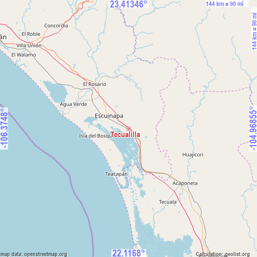
Tecualilla GPS coordinates[2]
22° 46' 0.012" North, 105° 40' 18.012" West
| Map corner | latitude | longitude |
|---|---|---|
| Upper-left | 23.41346°, | -106.3748° |
| Center: | 22.76667°, | -105.67167° |
| Lower-right: | 22.1168°, | -104.96855° |
| Map W x H: | 144.2×144.2 km | = 89.6×89.6mi |
| max Lat: | 32.7° ⇑12.5% North |
| Tecualilla: | 22.76667° |
| min Lat: | ⇓87.5% South 14.53588° |
| min Long | Tecualilla | max Long |
| -117.105° | -105.67167° | -86.73105° |
| W 6.5%⇐ | ⇒93.5% E |
Elevation
Elevation of Tecualilla is 14 m = 46 ft, and this is 1239.7 m = 4067 ft below average elevation for this country.
| Max E: |
3497 m = 11473 ft | 94.6% |
| Avg. | 1253.7 m = 4113 ft | |
| Tecualilla | 14 m = 46 ft | |
Min E: |
-1 m = -3 ft | 5.4% |
See also: Mexico elevation on elevation.city.
Geographical zone
Tecualilla is located in North Torrid zone (between Equator and Tropic of Cancer). Distance of this Northern Tropic circle is 74.5 km =46.3 mi to North.| Distance of | km | miles | from Tecualilla |
|---|---|---|---|
| North Pole | 7475.6 | 4645.1 | to North |
| Arctic Circle | 4869.8 | 3026 | to North |
| Tropic Cancer | 74.5 | 46.3 | to North |
| Equator | 2531.4 | 1572.9 | to South |


Nearby cities:
15 places around Tecualilla: (largest is in red/bold)
• Agua Verde
34 km =21.1 mi,  294°
294°
• Apoderado
30.3 km =18.8 mi,  301°
301°
• Chametla
31.8 km =19.8 mi, 292°
• Chilillos
30.9 km =19.2 mi,  325°
325°
• Cristo Rey
21.3 km =13.2 mi,  194°
194°
• Ejido Cajón Ojo de Agua Número Dos
34.1 km =21.2 mi, 295°
• El Aguaje
33.3 km =20.7 mi,  151°
151°
• El Pozole
29.7 km =18.5 mi, 303°
• El Rosario
31.4 km =19.5 mi,  322°
322°
• Escuinapa
13.1 km =8.1 mi, 304°
• Isla del Bosque
18.2 km =11.3 mi,  258°
258°
• Matatán
30.2 km =18.8 mi,  348°
348°
• Ojo de Agua de Palmillas
17.8 km =11.1 mi,  156°
156°
• Palmito del Verde
15.8 km =9.8 mi,  220°
220°
• Teacapan
26.1 km =16.2 mi, 194°
Sources, notices
• [Note1] Compared only with cities in Mexico existing in our database
• [Src1] Map data: © OpenStreetMap contributors (CC-BY-SA)
• [Src2] Other city data from geonames.org with taken over terms of usage.
• [Src3] Geographical zone / Annual Mean Temperature by Robert A. Rohde @ Wikipedia
