Ojo de Agua de Palmillas geodata
Ojo de Agua de Palmillas (Sinaloa) is a populated place; located in Mexico in America/Mazatlan (GMT-7) time zone. With population of 2,833 people, there are 3133 cities with bigger population in this country. Compared to other cities in Mexico, 87.1% of cities are located further ↓South; 93.4% of cities are located further →East and 96.3% of cities have higher elevation than Ojo de Agua de Palmillas. Note1
Current local time in Ojo de Agua de Palmillas:
11:31 AM, MondayDifference from your time zone: hours


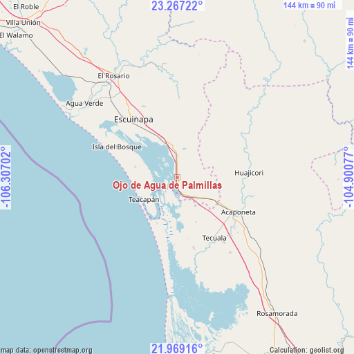
Ojo de Agua de Palmillas GPS coordinates[2]
22° 37' 10.992" North, 105° 36' 14.004" West
| Map corner | latitude | longitude |
|---|---|---|
| Upper-left | 23.26722°, | -106.30702° |
| Center: | 22.61972°, | -105.60389° |
| Lower-right: | 21.96916°, | -104.90077° |
| Map W x H: | 144.3×144.3 km | = 89.7×89.7mi |
| max Lat: | 32.7° ⇑12.9% North |
| Ojo de Agua de Palmillas: | 22.61972° |
| min Lat: | ⇓87.1% South 14.53588° |
| min Long | Ojo de Agua de | max Long |
| -117.105° | -105.60389° | -86.73105° |
| W 6.6%⇐ | ⇒93.4% E |
Elevation
Elevation of Ojo de Agua de Palmillas is 11 m = 36 ft, and this is 1242.7 m = 4077 ft below average elevation for this country.
| Max E: |
3497 m = 11473 ft | 96.3% |
| Avg. | 1253.7 m = 4113 ft | |
| Ojo de Agua de Palmillas | 11 m = 36 ft | |
Min E: |
-1 m = -3 ft | 3.7% |
See also: Mexico elevation on elevation.city.
Geographical zone
Ojo de Agua de Palmillas is located in North Torrid zone (between Equator and Tropic of Cancer). Distance of this Northern Tropic circle is 90.8 km =56.4 mi to North.| Distance of | km | miles | from Ojo de Agua de Palmillas |
|---|---|---|---|
| North Pole | 7492 | 4655.3 | to North |
| Arctic Circle | 4886.1 | 3036.1 | to North |
| Tropic Cancer | 90.8 | 56.4 | to North |
| Equator | 2515.1 | 1562.8 | to South |


Nearby cities:
15 places around Ojo de Agua de Palmillas: (largest is in red/bold)
• Cristo Rey
13.1 km =8.1 mi,  251°
251°
• El Aguaje
15.7 km =9.8 mi,  145°
145°
• El Centenario
27.4 km =17 mi,  116°
116°
• El Tigre
19.5 km =12.1 mi,  133°
133°
• Isla del Bosque
27.8 km =17.3 mi,  296°
296°
• La Concha (La Concepción)
18.3 km =11.4 mi, 121°
• Novillero
27.2 km =16.9 mi,  192°
192°
• Pajaritos
19.7 km =12.2 mi,  156°
156°
• Palmito del Verde
17.7 km =11 mi,  284°
284°
• Paso Hondo
25.2 km =15.7 mi,  169°
169°
• Río Viejo
26.2 km =16.3 mi, 164°
• San Cayetano
20.4 km =12.7 mi,  203°
203°
• San José de Gracia
27.8 km =17.3 mi, 123°
• Teacapan
16.2 km =10.1 mi,  236°
236°
• Tecualilla
17.8 km =11.1 mi,  336°
336°
Sources, notices
• [Note1] Compared only with cities in Mexico existing in our database
• [Src1] Map data: © OpenStreetMap contributors (CC-BY-SA)
• [Src2] Other city data from geonames.org with taken over terms of usage.
• [Src3] Geographical zone / Annual Mean Temperature by Robert A. Rohde @ Wikipedia
