Palmito del Verde geodata
Palmito del Verde (Sinaloa) is a populated place; located in Mexico in America/Mazatlan (GMT-7) time zone. With population of 1,499 people, there are 5759 cities with bigger population in this country. Compared to other cities in Mexico, 87.2% of cities are located further ↓South; 93.5% of cities are located further →East and 99.3% of cities have higher elevation than Palmito del Verde. Note1


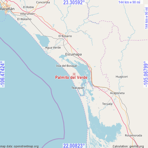
Palmito del Verde GPS coordinates[2]
22° 39' 30.996" North, 105° 46' 15.996" West
| Map corner | latitude | longitude |
|---|---|---|
| Upper-left | 23.30592°, | -106.47424° |
| Center: | 22.65861°, | -105.77111° |
| Lower-right: | 22.00823°, | -105.06799° |
| Map W x H: | 144.3×144.3 km | = 89.7×89.7mi |
| max Lat: | 32.7° ⇑12.8% North |
| Palmito del Verde: | 22.65861° |
| min Lat: | ⇓87.2% South 14.53588° |
| min Long | Palmito del Ver | max Long |
| -117.105° | -105.77111° | -86.73105° |
| W 6.5%⇐ | ⇒93.5% E |
Elevation
Elevation of Palmito del Verde is 5 m = 16 ft, and this is 1248.7 m = 4097 ft below average elevation for this country.
| Max E: |
3497 m = 11473 ft | 99.3% |
| Avg. | 1253.7 m = 4113 ft | |
| Palmito del Verde | 5 m = 16 ft | |
Min E: |
-1 m = -3 ft | 0.7% |
See also: Mexico elevation on elevation.city.
Geographical zone
Palmito del Verde is located in North Torrid zone (between Equator and Tropic of Cancer). Distance of this Northern Tropic circle is 86.5 km =53.7 mi to North.| Distance of | km | miles | from Palmito del Verde |
|---|---|---|---|
| North Pole | 7487.7 | 4652.6 | to North |
| Arctic Circle | 4881.8 | 3033.4 | to North |
| Tropic Cancer | 86.5 | 53.7 | to North |
| Equator | 2519.4 | 1565.5 | to South |


Nearby cities:
15 places around Palmito del Verde: (largest is in red/bold)
• Agua Verde
33.3 km =20.7 mi,  321°
321°
• Apoderado
31.9 km =19.8 mi,  330°
330°
• Chametla
30.9 km =19.2 mi, 321°
• Cristo Rey
9.8 km =6.1 mi,  150°
150°
• Ejido Cajón Ojo de Agua Número Dos
33.8 km =21 mi, 322°
• El Aguaje
31.3 km =19.4 mi,  123°
123°
• El Pozole
32 km =19.9 mi, 332°
• Escuinapa
19.4 km =12.1 mi,  357°
357°
• Isla del Bosque
11.3 km =7 mi, 317°
• Novillero
32.8 km =20.4 mi,  160°
160°
• Ojo de Agua de Palmillas
17.7 km =11 mi,  104°
104°
• Pajaritos
33.5 km =20.8 mi,  132°
132°
• San Cayetano
24.6 km =15.3 mi, 158°
• Teacapan
13.7 km =8.5 mi, 164°
• Tecualilla
15.8 km =9.8 mi,  40°
40°
Sources, notices
• [Note1] Compared only with cities in Mexico existing in our database
• [Src1] Map data: © OpenStreetMap contributors (CC-BY-SA)
• [Src2] Other city data from geonames.org with taken over terms of usage.
• [Src3] Geographical zone / Annual Mean Temperature by Robert A. Rohde @ Wikipedia
