Ejido Emiliano Zapata geodata
Ejido Emiliano Zapata (Coahuila) is a populated place; located in Mexico in America/Monterrey (GMT-6) time zone. With population of 828 people, there are 10560 cities with bigger population in this country. Compared to other cities in Mexico, 92.6% of cities are located further ↓South; 85.5% of cities are located further →East and 58.1% of cities have higher elevation than Ejido Emiliano Zapata. Note1


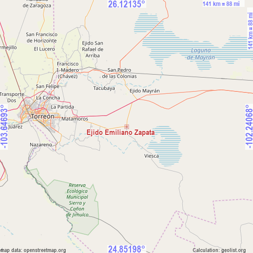
Ejido Emiliano Zapata GPS coordinates[2]
25° 29' 18.024" North, 102° 56' 37.68" West
| Map corner | latitude | longitude |
|---|---|---|
| Upper-left | 26.12135°, | -103.64693° |
| Center: | 25.48834°, | -102.9438° |
| Lower-right: | 24.85198°, | -102.24068° |
| Map W x H: | 141.1×141.1 km | = 87.7×87.7mi |
| max Lat: | 32.7° ⇑7.4% North |
| Ejido Emiliano Zapata: | 25.48834° |
| min Lat: | ⇓92.6% South 14.53588° |
| min Long | Ejido Emiliano | max Long |
| -117.105° | -102.9438° | -86.73105° |
| W 14.5%⇐ | ⇒85.5% E |
Elevation
Elevation of Ejido Emiliano Zapata is 1101 m = 3612 ft, and this is 152.7 m = 501 ft below average elevation for this country.
| Max E: |
3497 m = 11473 ft | 58.1% |
| Avg. | 1253.7 m = 4113 ft | |
| Ejido Emiliano Zapata | 1101 m = 3612 ft | |
Min E: |
-1 m = -3 ft | 41.9% |
See also: Mexico elevation on elevation.city.
Geographical zone
Ejido Emiliano Zapata is located in North temperate zone (between Tropic of Cancer and the Arctic Circle). Distance of this Northern Tropic circle is 228.1 km =141.7 mi to South.| Distance of | km | miles | from Ejido Emiliano Zapata |
|---|---|---|---|
| North Pole | 7173 | 4457.1 | to North |
| Arctic Circle | 4567.1 | 2837.9 | to North |
| Tropic Cancer | 228.1 | 141.7 | to South |
| Equator | 2834 | 1761 | to South |


Nearby cities:
15 places around Ejido Emiliano Zapata: (largest is in red/bold)
• Ejido Venustiano Carranza
15.3 km =9.5 mi,  184°
184°
• El Refugio
23.8 km =14.8 mi,  254°
254°
• Gabino Vázquez (San Luis)
12.1 km =7.5 mi,  267°
267°
• Hidalgo
19.8 km =12.3 mi, 270°
• Ignacio Zaragoza
23.9 km =14.9 mi,  352°
352°
• Ignacio Zaragoza
24.5 km =15.2 mi,  234°
234°
• Mayran
22.9 km =14.2 mi,  26°
26°
• San Esteban de Abajo
25.2 km =15.7 mi, 346°
• San Felipe
21 km =13 mi, 351°
• San Marcos
20.9 km =13 mi,  341°
341°
• San Miguel
23.5 km =14.6 mi,  358°
358°
• San Rafael de Abajo
20.1 km =12.5 mi, 341°
• Santa Elena
24.2 km =15 mi, 339°
• Tacubaya
25.1 km =15.6 mi,  330°
330°
• Viesca
21.7 km =13.5 mi,  139°
139°
Sources, notices
• [Note1] Compared only with cities in Mexico existing in our database
• [Src1] Map data: © OpenStreetMap contributors (CC-BY-SA)
• [Src2] Other city data from geonames.org with taken over terms of usage.
• [Src3] Geographical zone / Annual Mean Temperature by Robert A. Rohde @ Wikipedia
