Lamadrid geodata
Lamadrid (Coahuila) is a seat of a second-order administrative division; located in Mexico in America/Monterrey (GMT-6) time zone. With population of 1,801 people, there are 4831 cities with bigger population in this country. Compared to other cities in Mexico, 96.4% of cities are located further ↓South; 79.7% of cities are located further →East and 65.7% of cities have higher elevation than Lamadrid. Note1


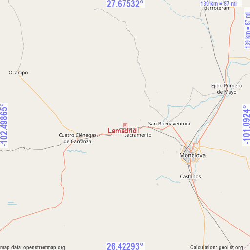
Lamadrid GPS coordinates[2]
27° 3' 3.132" North, 101° 47' 43.872" West
| Map corner | latitude | longitude |
|---|---|---|
| Upper-left | 27.67532°, | -102.49865° |
| Center: | 27.05087°, | -101.79552° |
| Lower-right: | 26.42293°, | -101.0924° |
| Map W x H: | 139.3×139.3 km | = 86.6×86.6mi |
| max Lat: | 32.7° ⇑3.6% North |
| Lamadrid: | 27.05087° |
| min Lat: | ⇓96.4% South 14.53588° |
| min Long | Lamadrid | max Long |
| -117.105° | -101.79552° | -86.73105° |
| W 20.3%⇐ | ⇒79.7% E |
Elevation
Elevation of Lamadrid is 651 m = 2136 ft, and this is 602.7 m = 1977 ft below average elevation for this country.
| Max E: |
3497 m = 11473 ft | 65.7% |
| Avg. | 1253.7 m = 4113 ft | |
| Lamadrid | 651 m = 2136 ft | |
Min E: |
-1 m = -3 ft | 34.3% |
See also: Mexico elevation on elevation.city.
Geographical zone
Lamadrid is located in North temperate zone (between Tropic of Cancer and the Arctic Circle). Distance of this Northern Tropic circle is 401.9 km =249.7 mi to South.| Distance of | km | miles | from Lamadrid |
|---|---|---|---|
| North Pole | 6999.3 | 4349.2 | to North |
| Arctic Circle | 4393.4 | 2729.9 | to North |
| Tropic Cancer | 401.9 | 249.7 | to South |
| Equator | 3007.8 | 1869 | to South |


Nearby cities:
15 places around Lamadrid: (largest is in red/bold)
• Abasolo
39.2 km =24.4 mi,  68°
68°
• Castaños
46.3 km =28.8 mi,  128°
128°
• Colonia Diana Laura Riojas de Colosio
32.2 km =20 mi,  104°
104°
• Cuatro Ciénegas de Carranza
27.6 km =17.1 mi,  254°
254°
• Escobedo
43 km =26.7 mi,  61°
61°
• Frontera
36.7 km =22.8 mi,  111°
111°
• La Cruz
30.4 km =18.9 mi, 102°
• Monclova
40.5 km =25.2 mi, 113°
• Nadadores
20.1 km =12.5 mi, 97°
• Ocampo
66.3 km =41.2 mi,  296°
296°
• Ocho de Enero
30.3 km =18.8 mi, 101°
• Primero de Mayo
60.2 km =37.4 mi, 69°
• Sacramento
8.8 km =5.5 mi, 127°
• San Buenaventura
24.5 km =15.2 mi,  87°
87°
• San José de Aura
72.9 km =45.3 mi,  34°
34°
Sources, notices
• [Note1] Compared only with cities in Mexico existing in our database
• [Src1] Map data: © OpenStreetMap contributors (CC-BY-SA)
• [Src2] Other city data from geonames.org with taken over terms of usage.
• [Src3] Geographical zone / Annual Mean Temperature by Robert A. Rohde @ Wikipedia
