Escobedo geodata
Escobedo (Coahuila) is a seat of a second-order administrative division; located in Mexico in America/Monterrey (GMT-6) time zone. With population of 533 people, there are 15888 cities with bigger population in this country. Compared to other cities in Mexico, 96.6% of cities are located further ↓South; 76.6% of cities are located further →East and 69.4% of cities have higher elevation than Escobedo. Note1


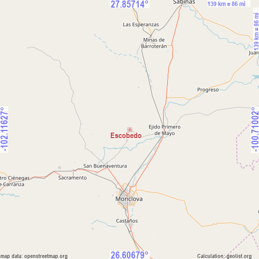
Escobedo GPS coordinates[2]
27° 14' 1.392" North, 101° 24' 47.304" West
| Map corner | latitude | longitude |
|---|---|---|
| Upper-left | 27.85714°, | -102.11627° |
| Center: | 27.23372°, | -101.41314° |
| Lower-right: | 26.60679°, | -100.71002° |
| Map W x H: | 139×139 km | = 86.4×86.4mi |
| max Lat: | 32.7° ⇑3.4% North |
| Escobedo: | 27.23372° |
| min Lat: | ⇓96.6% South 14.53588° |
| min Long | Escobedo | max Long |
| -117.105° | -101.41314° | -86.73105° |
| W 23.4%⇐ | ⇒76.6% E |
Elevation
Elevation of Escobedo is 446 m = 1463 ft, and this is 807.7 m = 2650 ft below average elevation for this country.
| Max E: |
3497 m = 11473 ft | 69.4% |
| Avg. | 1253.7 m = 4113 ft | |
| Escobedo | 446 m = 1463 ft | |
Min E: |
-1 m = -3 ft | 30.6% |
See also: Mexico elevation on elevation.city.
Geographical zone
Escobedo is located in North temperate zone (between Tropic of Cancer and the Arctic Circle). Distance of this Northern Tropic circle is 422.2 km =262.3 mi to South.| Distance of | km | miles | from Escobedo |
|---|---|---|---|
| North Pole | 6979 | 4336.5 | to North |
| Arctic Circle | 4373.1 | 2717.3 | to North |
| Tropic Cancer | 422.2 | 262.3 | to South |
| Equator | 3028.1 | 1881.6 | to South |


Nearby cities:
15 places around Escobedo: (largest is in red/bold)
• Abasolo
5.9 km =3.7 mi,  193°
193°
• Colonia Diana Laura Riojas de Colosio
29.3 km =18.2 mi, 193°
• Frontera
34.2 km =21.3 mi, 186°
• La Cruz
27.9 km =17.3 mi,  197°
197°
• Lamadrid
43 km =26.7 mi,  241°
241°
• Minas de Barroterán
48.2 km =30 mi,  15°
15°
• Monclova
36.3 km =22.6 mi,  181°
181°
• Nadadores
29 km =18 mi,  218°
218°
• Ocho de Enero
27.5 km =17.1 mi, 197°
• Primero de Mayo
18.7 km =11.6 mi,  88°
88°
• Progreso
47.2 km =29.3 mi,  62°
62°
• Sacramento
40.1 km =24.9 mi,  230°
230°
• San Buenaventura
23.4 km =14.5 mi, 215°
• San José de Aura
39.6 km =24.6 mi,  5°
5°
• Valle Dorado
48 km =29.8 mi, 16°
Sources, notices
• [Note1] Compared only with cities in Mexico existing in our database
• [Src1] Map data: © OpenStreetMap contributors (CC-BY-SA)
• [Src2] Other city data from geonames.org with taken over terms of usage.
• [Src3] Geographical zone / Annual Mean Temperature by Robert A. Rohde @ Wikipedia
