Nadadores geodata
Nadadores (Coahuila) is a seat of a second-order administrative division; located in Mexico in America/Monterrey (GMT-6) time zone. With population of 4,343 people, there are 2114 cities with bigger population in this country. Compared to other cities in Mexico, 96.4% of cities are located further ↓South; 78.1% of cities are located further →East and 68.1% of cities have higher elevation than Nadadores. Note1


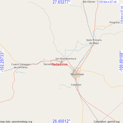
Nadadores GPS coordinates[2]
27° 1' 41.484" North, 101° 35' 39.12" West
| Map corner | latitude | longitude |
|---|---|---|
| Upper-left | 27.65277°, | -102.29733° |
| Center: | 27.02819°, | -101.5942° |
| Lower-right: | 26.40012°, | -100.89108° |
| Map W x H: | 139.3×139.3 km | = 86.6×86.6mi |
| max Lat: | 32.7° ⇑3.6% North |
| Nadadores: | 27.02819° |
| min Lat: | ⇓96.4% South 14.53588° |
| min Long | Nadadores | max Long |
| -117.105° | -101.5942° | -86.73105° |
| W 21.9%⇐ | ⇒78.1% E |
Elevation
Elevation of Nadadores is 526 m = 1726 ft, and this is 727.7 m = 2387 ft below average elevation for this country.
| Max E: |
3497 m = 11473 ft | 68.1% |
| Avg. | 1253.7 m = 4113 ft | |
| Nadadores | 526 m = 1726 ft | |
Min E: |
-1 m = -3 ft | 31.9% |
See also: Mexico elevation on elevation.city.
Geographical zone
Nadadores is located in North temperate zone (between Tropic of Cancer and the Arctic Circle). Distance of this Northern Tropic circle is 399.3 km =248.1 mi to South.| Distance of | km | miles | from Nadadores |
|---|---|---|---|
| North Pole | 7001.8 | 4350.7 | to North |
| Arctic Circle | 4395.9 | 2731.5 | to North |
| Tropic Cancer | 399.3 | 248.1 | to South |
| Equator | 3005.3 | 1867.4 | to South |


Nearby cities:
15 places around Nadadores: (largest is in red/bold)
• Abasolo
23.8 km =14.8 mi,  43°
43°
• Castaños
31 km =19.3 mi,  148°
148°
• Colonia Diana Laura Riojas de Colosio
12.6 km =7.8 mi,  116°
116°
• Cuatro Ciénegas de Carranza
46.8 km =29.1 mi,  264°
264°
• Escobedo
29 km =18 mi, 38°
• Frontera
17.9 km =11.1 mi,  128°
128°
• La Cruz
10.5 km =6.5 mi,  111°
111°
• Lamadrid
20.1 km =12.5 mi,  277°
277°
• Monclova
21.9 km =13.6 mi, 128°
• Ocho de Enero
10.3 km =6.4 mi, 109°
• Primero de Mayo
43.4 km =27 mi,  57°
57°
• Progreso
74.6 km =46.4 mi,  53°
53°
• Sacramento
13.2 km =8.2 mi, 257°
• San Buenaventura
5.8 km =3.6 mi, 50°
• San José de Aura
66 km =41 mi,  19°
19°
Sources, notices
• [Note1] Compared only with cities in Mexico existing in our database
• [Src1] Map data: © OpenStreetMap contributors (CC-BY-SA)
• [Src2] Other city data from geonames.org with taken over terms of usage.
• [Src3] Geographical zone / Annual Mean Temperature by Robert A. Rohde @ Wikipedia
