Nuevo San Diego (El Caballo) geodata
Nuevo San Diego (El Caballo) (Durango) is a populated place; located in Mexico in America/Monterrey (GMT-6) time zone. With population of 558 people, there are 15286 cities with bigger population in this country. Compared to other cities in Mexico, 91.8% of cities are located further ↓South; 93.7% of cities are located further →East and 95.2% of cities have lower elevation than Nuevo San Diego (El Caballo). Note1
Current local time in Nuevo San Diego (El Caballo):
11:33 AM, MondayDifference from your time zone: hours


Nuevo San Diego (El Caballo) GPS coordinates[2]
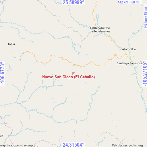
24° 57' 15.012" North, 105° 58' 27.012" West
| Map corner | latitude | longitude |
|---|---|---|
| Upper-left | 25.58999°, | -106.6773° |
| Center: | 24.95417°, | -105.97417° |
| Lower-right: | 24.31504°, | -105.27105° |
| Map W x H: | 141.8×141.8 km | = 88.1×88.1mi |
| max Lat: | 32.7° ⇑8.2% North |
| Nuevo San Diego (El Caballo): | 24.95417° |
| min Lat: | ⇓91.8% South 14.53588° |
| min Long | Nuevo San Diego | max Long |
| -117.105° | -105.97417° | -86.73105° |
| W 6.3%⇐ | ⇒93.7% E |
Elevation
Elevation of Nuevo San Diego (El Caballo) is 2601 m = 8533 ft, and this is 1347.3 m = 4420 ft above average elevation for this country.
| Max E: |
3497 m = 11473 ft | 4.8% |
| Nuevo San Diego (El Caballo) | 2601 m 8533 ft | |
| Avg. | 1253.7 m = 4113 ft | |
Min E: |
-1 m = -3 ft | 95.2% |
See also: Mexico elevation on elevation.city.
Geographical zone
Nuevo San Diego (El Caballo) is located in North temperate zone (between Tropic of Cancer and the Arctic Circle). Distance of this Northern Tropic circle is 168.7 km =104.8 mi to South.| Distance of | km | miles | from Nuevo San Diego (El Caballo) |
|---|---|---|---|
| North Pole | 7232.4 | 4494 | to North |
| Arctic Circle | 4626.5 | 2874.8 | to North |
| Tropic Cancer | 168.7 | 104.8 | to South |
| Equator | 2774.6 | 1724.1 | to South |


Nearby cities:
15 places around Nuevo San Diego (El Caballo): (largest is in red/bold)
• Canelas
60.6 km =37.7 mi,  288°
288°
• Ciénega de Nuestra Señora de Guadalupe
37.7 km =23.4 mi, 288°
• Cosalá
94 km =58.4 mi,  230°
230°
• José María Morelos
77.4 km =48.1 mi,  85°
85°
• Los Herrera
52.8 km =32.8 mi,  64°
64°
• Nuevo Ideal
90.9 km =56.5 mi, 94°
• Otaéz
28.3 km =17.6 mi,  184°
184°
• San Miguel de Cruces
61.7 km =38.3 mi,  167°
167°
• Santa Catarina de Tepehuanes
49.7 km =30.9 mi,  30°
30°
• Santiago Papasquiaro
56.8 km =35.3 mi,  79°
79°
• Tayoltita
94.8 km =58.9 mi, 177°
• Tejamen
86.1 km =53.5 mi,  101°
101°
• Topia
66.6 km =41.4 mi,  295°
295°
• Vencedores
64.2 km =39.9 mi,  155°
155°
• Villa Hermosa
86.7 km =53.9 mi, 97°
Sources, notices
• [Note1] Compared only with cities in Mexico existing in our database
• [Src1] Map data: © OpenStreetMap contributors (CC-BY-SA)
• [Src2] Other city data from geonames.org with taken over terms of usage.
• [Src3] Geographical zone / Annual Mean Temperature by Robert A. Rohde @ Wikipedia
